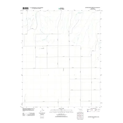
2012 Map of Sleeping Bear Creek SE
USGS Topo · Published 2012About this map
Lathrop Cem serves as a small historical anchor in this rural portion of Woodward County, sitting amidst a landscape defined by an orderly grid of local roads and natural drainage. The northern reaches of the sheet are marked by the presence of Vandorn Number 3 Reservoir and the headwaters of Traders Cr, while the winding path of Sleeping Bear Cr cuts through the northwestern corner. The infrastructure here is heavily tied to local resource extraction, evidenced by the prominent Oil Lease Rd and a network of section line roads like E0300 Rd and N2070 Rd that partition the landscape. This 2012 survey illustrates the intersection of traditional agricultural land divisions with the practical requirements of modern energy production and water management in the Oklahoma plains.
Find a feature on this map
21 named features on this map. Tap any name to fly to it.
Don’t see what you’re looking for? This feature index may not catch every label — zoom into the map to look around manually.
Map Details
Editions of this 2012 Sleeping Bear Creek SE Map
This is the sole edition of this map. No revisions or reprints were ever made.
Other maps of this area

1955 · Woodward
USGS Topo · 1:250,000

1958 · Woodward
USGS Topo · 1:250,000

1969 · Woodward
USGS Topo · 1:24,000

1969 · Mooreland
USGS Topo · 1:24,000

1969 · Woodward NE
USGS Topo · 1:24,000

1970 · Fairvalley SW
USGS Topo · 1:24,000

1970 · Alabaster Caverns
USGS Topo · 1:24,000

1970 · Sleeping Bear Creek SW
USGS Topo · 1:24,000

1970 · Sleeping Bear Creek NW
USGS Topo · 1:24,000

1970 · Sleeping Bear Creek SE
USGS Topo · 1:24,000