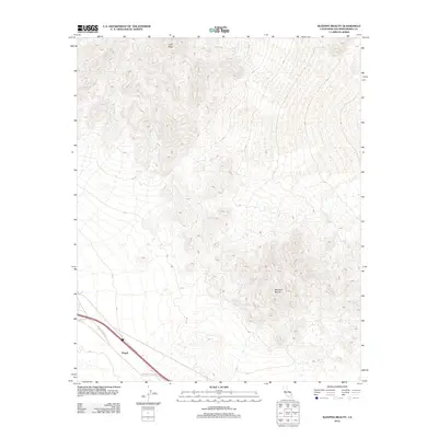
2012 Map of Sleeping Beauty
USGS Topo · Published 2012About this map
Sleeping Beauty and Cady Peak define the high desert topography of this Mojave landscape in San Bernardino County. In the early 21st century, the southern portion of this quadrangle serves as a primary transit corridor, marked by the historic National Trails Hwy and its proximity to the rail siding at Pisgah. This area preserves a stark desert environment where infrastructure is concentrated along the base of the mountains. The presence of Pisgah Crater Rd indicates the local significance of the nearby volcanic field, providing access to the geologically distinct terrain that characterizes this part of the California desert.
Find a feature on this map
5 named features on this map. Tap any name to fly to it.
Don’t see what you’re looking for? This feature index may not catch every label — zoom into the map to look around manually.
Map Details
Editions of this 2012 Sleeping Beauty Map
This is the sole edition of this map. No revisions or reprints were ever made.
Other maps of this area

1953 · San Bernardino
USGS Topo · 1:250,000

1955 · Ludlow
USGS Topo · 1:24,000

1955 · Sunshine Peak
USGS Topo · 1:24,000

1955 · Lavic Lake
USGS Topo · 1:24,000

1955 · Lavic
USGS Topo · 1:62,500

1955 · Cady Mountains
USGS Topo · 1:62,500

1955 · Broadwell Lake
USGS Topo · 1:62,500

1955 · Ludlow
USGS Topo · 1:62,500

1956 · San Bernardino
USGS Topo · 1:250,000

1957 · San Bernardino
USGS Topo · 1:250,000