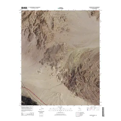
2015 Map of Sleeping Beauty
USGS Topo · Published 2015About this map
The Mojave Desert landscape is defined by the stark transition from alluvial fans to the prominent peaks of the Cady Mountains. This 2015 survey identifies Cady Peak as a primary landmark in the north, while the southern portion of the quadrangle is marked by Sleeping Beauty, a feature that gives the area its name. The mapping detail reveals the complex network of dry washes extending eastward from the mountain range into the surrounding basin. Modern infrastructure is represented by the path of Interstate 40 and the railroad near Pisgah in the southwest corner, showing how transportation corridors navigate this arid environment. The map provides a clear look at the Public Land Survey System grid, including boundaries for Township 9 North, Range 6 East and adjacent ranges, which is essential for locating specific land parcels in this section of San Bernardino County.
Find a feature on this map
10 named features on this map. Tap any name to fly to it.
Don’t see what you’re looking for? This feature index may not catch every label — zoom into the map to look around manually.
Map Details
Editions of this 2015 Sleeping Beauty Map
This is the sole edition of this map. No revisions or reprints were ever made.
Other maps of this area

1953 · San Bernardino
USGS Topo · 1:250,000

1955 · Ludlow
USGS Topo · 1:24,000

1955 · Sunshine Peak
USGS Topo · 1:24,000

1955 · Lavic Lake
USGS Topo · 1:24,000

1955 · Lavic
USGS Topo · 1:62,500

1955 · Cady Mountains
USGS Topo · 1:62,500

1955 · Broadwell Lake
USGS Topo · 1:62,500

1955 · Ludlow
USGS Topo · 1:62,500

1956 · San Bernardino
USGS Topo · 1:250,000

1957 · San Bernardino
USGS Topo · 1:250,000