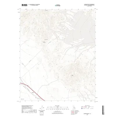
2018 Map of Sleeping Beauty
USGS Topo · Published 2018About this map
Pisgah Crater and the volcanic terrain of the Mojave Desert dominate this southern California landscape. The settlement of Pisgah serves as a lone landmark along the historic National Trails Hwy, illustrating the corridor's role as a primary desert thoroughfare. The topography rises sharply from the basin into the Cady Mountains, reaching high points at Cady Peak and the distinctive profile of Sleeping Beauty.
Find a feature on this map
14 named features on this map. Tap any name to fly to it.
Don’t see what you’re looking for? This feature index may not catch every label — zoom into the map to look around manually.
Map Details
Editions of this 2018 Sleeping Beauty Map
This is the sole edition of this map. No revisions or reprints were ever made.
Other maps of this area

1953 · San Bernardino
USGS Topo · 1:250,000

1955 · Ludlow
USGS Topo · 1:24,000

1955 · Sunshine Peak
USGS Topo · 1:24,000

1955 · Lavic Lake
USGS Topo · 1:24,000

1955 · Lavic
USGS Topo · 1:62,500

1955 · Cady Mountains
USGS Topo · 1:62,500

1955 · Broadwell Lake
USGS Topo · 1:62,500

1955 · Ludlow
USGS Topo · 1:62,500

1956 · San Bernardino
USGS Topo · 1:250,000

1957 · San Bernardino
USGS Topo · 1:250,000