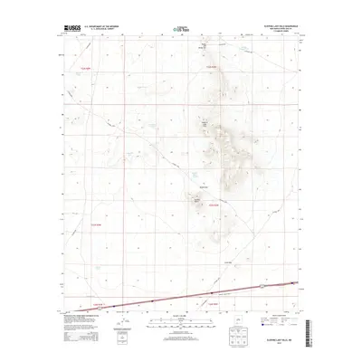
2013 Map of Sleeping Lady Hills
USGS Topo · Published 2013About this map
Sleeping Lady Hills and the prominent Reichey Butte dominate this arid landscape in Doña Ana County. This 2013 survey illustrates a region defined by its water management and transit routes through high desert terrain. The distribution of scattered water sources, such as Martin Tank, Middle Pasture Tank, and Green Tank, points to the area's continued use for ranching and livestock. Topographic features like Rough and Ready Gap, Middle Gap, and Little Gap indicate natural corridors through the hills. Modern transportation is represented by Robert Larson Blvd and Interstate 10, which cross the southern portion of the quadrangle. The map also traces a network of local ranch roads, including Co Road C008 and Co Road D012, connecting these isolated landmarks across the Chihuahuan Desert landscape.
Find a feature on this map
26 named features on this map. Tap any name to fly to it.
Don’t see what you’re looking for? This feature index may not catch every label — zoom into the map to look around manually.
Map Details
Editions of this 2013 Sleeping Lady Hills Map
This is the sole edition of this map. No revisions or reprints were ever made.
Other maps of this area

1891 · Las Cruces
USGS Topo · 1:125,000

1893 · Las Cruces
USGS Topo · 1:125,000

1941 · Las Cruces
USGS Topo · 1:62,500

1941 · Aden
USGS Topo · 1:62,500

1943 · Aden
USGS Topo · 1:62,500

1943 · Corralitos Ranch
USGS Topo · 1:62,500

1943 · Afton
USGS Topo · 1:62,500

1943 · Las Cruces
USGS Topo · 1:62,500

1955 · Las Cruces
USGS Topo · 1:250,000

1958 · Las Cruces
USGS Topo · 1:250,000