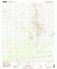
1996 Map of Sleeping Lady Hills
USGS Topo · Published 2001About this map
The Sleeping Lady Hills dominate this portion of the Doña Ana landscape, providing a rugged vertical contrast to the surrounding desert basin. This 1996 provisional survey documents a transition in land use, where long-established ranching infrastructure meets modern communications and historical preservation. Cattle tanks such as Middle Pasture Tank, North Kimble Tank, and South Kimble Tank are scattered across the terrain, connected by drainage features like Kimble Draw.
Find a feature on this map
17 named features on this map. Tap any name to fly to it.
Don’t see what you’re looking for? This feature index may not catch every label — zoom into the map to look around manually.
Map Details
Editions of this 1996 Sleeping Lady Hills Map
This is the sole edition of this map. No revisions or reprints were ever made.
Other maps of this area

1891 · Las Cruces
USGS Topo · 1:125,000

1893 · Las Cruces
USGS Topo · 1:125,000

1941 · Las Cruces
USGS Topo · 1:62,500

1941 · Aden
USGS Topo · 1:62,500

1943 · Aden
USGS Topo · 1:62,500

1943 · Corralitos Ranch
USGS Topo · 1:62,500

1943 · Afton
USGS Topo · 1:62,500

1943 · Las Cruces
USGS Topo · 1:62,500

1955 · Las Cruces
USGS Topo · 1:250,000

1958 · Las Cruces
USGS Topo · 1:250,000