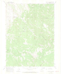
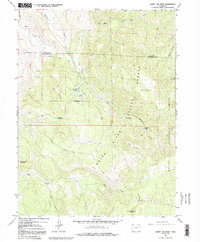
1966 Map of Sleepy Cat Peak
USGS Topo · Published 1969About this map
White River National Forest dominates the high-altitude landscape of this mid-1960s survey, where the boundary between Moffat and Rio Blanco counties follows the rugged terrain. The area is characterized by an extensive network of water management features, including the Carrigan Averill Ditch and several high-country basins such as Owen-Carrigan Reservoir and Konapik Reservoir. These features, alongside the Morapos Cow Camp, suggest a landscape shaped by seasonal livestock grazing and the essential movement of water across the divide. Peaks like Sleepy Cat Peak and Baldy Mountain rise above the complex drainage systems of Milk Creek and Morapos Creek. The presence of a Gas Well in the northern gulches indicates the early stages of energy exploration entering this remote portion of the forest, while old pack trails continue to serve as the primary routes through the timbered slopes.
Find a feature on this map
31 named features on this map. Tap any name to fly to it.
Don’t see what you’re looking for? This feature index may not catch every label — zoom into the map to look around manually.
Map Details
Editions of this 1966 Sleepy Cat Peak Map
5 editions found
Other maps of this area

1910 · Danforth Hills
USGS Topo · 1:125,000

1915 · Monument Butte
USGS Topo · 1:62,500

1916 · Daton Peak
USGS Topo · 1:62,500

1920 · Daton Peak
USGS Topo · 1:62,500

1954 · Craig
USGS Topo · 1:250,000

1957 · Craig
USGS Topo · 1:250,000

1958 · Craig
USGS Topo · 1:250,000

1960 · Craig
USGS Topo · 1:250,000

1962 · Craig
USGS Topo · 1:250,000

1964 · Craig
USGS Topo · 1:250,000