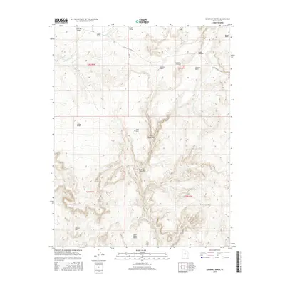
2017 Map of Slickrock Bench
USGS Topo · Published 2017About this map
Slickrock Bench serves as the focal point for this 2017 survey of the Kane County landscape, where the high desert is defined by a complex network of seasonal drainages and named landmarks. The geography is dominated by notable canyons and draws, including the serpentine path of Hackberry Canyon and the convergence of Death Valley Draw and Upper Death Valley. These natural corridors have historically dictated movement through the region, now tracked by routes such as Cottonwood Canyon Rd. Significant terrain features like Johnson Hole and Jodey Point provide specific reference points for land management and navigation. The presence of Round Valley Seep and various creek beds like Rock Springs Cr highlights the sparse but critical water sources that sustain this arid environment.
Find a feature on this map
27 named features on this map. Tap any name to fly to it.
Don’t see what you’re looking for? This feature index may not catch every label — zoom into the map to look around manually.
Map Details
Editions of this 2017 Slickrock Bench Map
This is the sole edition of this map. No revisions or reprints were ever made.
Other maps of this area

1886 · Kanab
USGS Topo · 1:250,000

1886 · Escalante
USGS Topo · 1:250,000

1953 · Cedar City
USGS Topo · 1:250,000

1955 · The Cockscob SW
USGS Topo · 1:24,000

1956 · Escalante
USGS Topo · 1:250,000

1958 · Cedar City
USGS Topo · 1:250,000

1960 · Escalante
USGS Topo · 1:250,000

1962 · Cedar City
USGS Topo · 1:250,000

1964 · Horse Flat
USGS Topo · 1:24,000

1964 · Canaan Peak
USGS Topo · 1:24,000