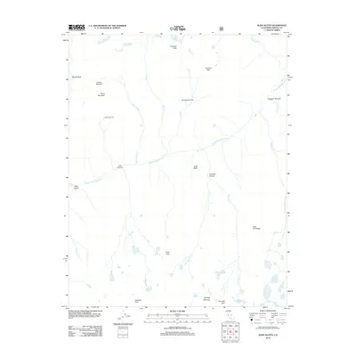
2012 Map of Slide Bluffs
USGS Topo · Published 2012About this map
The Middle Fork Kings River carves a deep path through this high-elevation landscape in the southern Sierra Nevada, serving as the central drainage for a network of tributaries. To the north, Tunemah Peak and Tunemah Pass overlook a series of alpine basins including Bunchgrass Flat and Grouse Meadow. The map reveals the seasonal patterns of high-country land use, evidenced by the presence of Lightning Corral and the broad expanse of Simpson Meadow. The topography is defined by sharp vertical transitions, from the precipitous Slide Bluffs and Kennedy Canyon to numerous high-altitude water bodies such as the Volcanic Lakes, Slide Lakes, and West Kennedy Lake. This 2012 survey provides a clear look at the drainage systems of Goddard Cr and Rattlesnake Cr, which feed the river system in a region where travel is constrained by landmarks like Kennedy Pass.
Find a feature on this map
35 named features on this map. Tap any name to fly to it.
Don’t see what you’re looking for? This feature index may not catch every label — zoom into the map to look around manually.
Map Details
Editions of this 2012 Slide Bluffs Map
This is the sole edition of this map. No revisions or reprints were ever made.
Other maps of this area

1903 · Tehipite
USGS Topo · 1:125,000

1905 · Tehipite
USGS Topo · 1:125,000

1912 · Mt. Goddard
USGS Topo · 1:125,000

1947 · Mariposa
USGS Topo · 1:250,000

1948 · Fresno
USGS Topo · 1:250,000

1948 · Mariposa
USGS Topo · 1:250,000

1948 · Mt. Goddard
USGS Topo · 1:62,500

1951 · Mt. Goddard
USGS Topo · 1:62,500

1952 · Mt. Goddard
USGS Topo · 1:62,500

1952 · Tehipite Dome
USGS Topo · 1:62,500