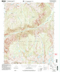
2004 Map of Slide Bluffs
USGS Topo · Published 2007About this map
Simpson Meadow and the surrounding high-country wilderness of the Sierra Nevada are documented here as they appeared in the early 21st century. The map highlights the rugged drainage systems of the Middle Fork Kings River, where deep canyons like the Gorge of Despair and Lost Canyon cut through massive granitic formations. This area serves as a critical junction for the Kings Canyon National Park and the Sequoia-Kings Canyon Wilderness, characterized by a network of alpine creeks and dramatic elevations such as Tunemah Peak and the White Divide.
Find a feature on this map
49 named features on this map. Tap any name to fly to it.
Don’t see what you’re looking for? This feature index may not catch every label — zoom into the map to look around manually.
Map Details
Editions of this 2004 Slide Bluffs Map
This is the sole edition of this map. No revisions or reprints were ever made.
Other maps of this area

1903 · Tehipite
USGS Topo · 1:125,000

1905 · Tehipite
USGS Topo · 1:125,000

1912 · Mt. Goddard
USGS Topo · 1:125,000

1947 · Mariposa
USGS Topo · 1:250,000

1948 · Fresno
USGS Topo · 1:250,000

1948 · Mariposa
USGS Topo · 1:250,000

1948 · Mt. Goddard
USGS Topo · 1:62,500

1951 · Mt. Goddard
USGS Topo · 1:62,500

1952 · Mt. Goddard
USGS Topo · 1:62,500

1952 · Tehipite Dome
USGS Topo · 1:62,500