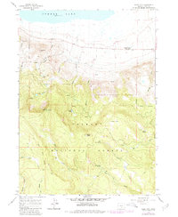
1966 Map of Slide Mtn
USGS Topo · Published 1980About this map
Summer Lake defines the northern edge of this high-desert landscape, where the basin floor meets the steep rising slopes of the Fremont National Forest. High points like Slide Mtn Lookout Tower and Monument Rock survey a terrain marked by volcanic buttes and numerous seasonal water sources, including Hanan Spring and Strawberry Spring. The 1966 survey, later updated in 1980, documents a network of high-elevation waters such as Slide Lakes, Withers Lake, and Potts Lake, which feed the drainages of Mill Creek and Bear Creek. A significant historical line, the Old Indian Treaty Boundary, cuts through the southern portion of the map, intersecting the Sycan River and various pack trails. This boundary and the presence of the Summer Lake Hot Spring near the lake's shore indicate the area's long-standing importance for both travel and geothermal activity in Lake County.
Find a feature on this map
31 named features on this map. Tap any name to fly to it.
Don’t see what you’re looking for? This feature index may not catch every label — zoom into the map to look around manually.
Map Details
Editions of this 1966 Slide Mtn Map
2 editions found
Other maps of this area

1955 · Klamath Falls
USGS Topo · 1:250,000

1958 · Klamath Falls
USGS Topo · 1:250,000

1966 · Morgan Butte
USGS Topo · 1:24,000

1966 · Slide Mtn
USGS Topo · 1:24,000

1966 · Harvey Creek
USGS Topo · 1:24,000

1966 · Fremont Point
USGS Topo · 1:24,000

1966 · Coffeepot Creek
USGS Topo · 1:24,000

1966 · Paisley
USGS Topo · 1:24,000

1966 · Lee Thomas Crossing
USGS Topo · 1:24,000

1974 · Lake Abert
USGS Topo · 1:100,000