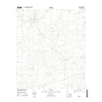
2014 Map of Slocomb
USGS Topo · Published 2014About this map
The town of Slocomb anchors this portion of Geneva County, characterized by a complex network of small creeks and branches that drain the Alabama coastal plain. This landscape is defined by the headwaters of Wrights Cr, Grant Br, and the curiously named Lighter Snag Cr, which weave through the agricultural and timber lands between local settlements. The map illustrates a rural continuity, where major thoroughfares like Al-52 and Al-103 connect the primary town center with outlying communities such as Malvern and Fadette.
Find a feature on this map
72 named features on this map. Tap any name to fly to it.
Don’t see what you’re looking for? This feature index may not catch every label — zoom into the map to look around manually.
Map Details
Editions of this 2014 Slocomb Map
This is the sole edition of this map. No revisions or reprints were ever made.
Other maps of this area

1942 · Enterprise
USGS Topo · 1:125,000

1950 · Esto
USGS Topo · 1:24,000

1951 · Graceville
USGS Topo · 1:24,000

1951 · Esto
USGS Topo · 1:24,000

1952 · Campbellton
USGS Topo · 1:24,000

1953 · Dothan
USGS Topo · 1:250,000

1954 · Dothan
USGS Topo · 1:250,000

1954 · Tallahassee
USGS Topo · 1:250,000

1955 · Dothan
USGS Topo · 1:250,000

1957 · Malvern
USGS Topo · 1:24,000