
1955 Map of Slocum
USGS Topo · Published 1957About this map
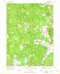
Exeter and the surrounding woodlands of Washington County are revealed here in a mid-century survey that documents the rural character of central Rhode Island. The landscape is dotted with small settlements like Slocum and Liberty, connected by historic routes including the New London Turnpike and Ten Rod Road. The New York New Haven and Hartford Railroad cuts through the eastern portion of the map, serving as a primary transit corridor alongside landmarks such as the Exeter State Sch and the South County Museum. Numerous family-named hills like Casey Hill and Hopkins Hill rise above the wetlands of Money Swamp and Arrow Swamp, illustrating the complex drainage patterns of the Queen River watershed. This 1955 revision preserves the locations of numerous country cemeteries and community hubs like the Slocum Grange, essential for tracing local genealogy and the evolution of these small crossroads villages.
Find a feature on this map
86 named features on this map. Tap any name to fly to it.
Don’t see what you’re looking for? This feature index may not catch every label — zoom into the map to look around manually.
Map Details
Editions of this 1955 Slocum Map
5 editions found
Other maps of this area

1889 · Charlestown
USGS Topo · 1:62,500

1889 · Newport
USGS Topo · 1:62,500

1890 · Narragansett Bay
USGS Topo · 1:62,500

1890 · Kent
USGS Topo · 1:62,500

1892 · Narragansett Bay
USGS Topo · 1:62,500

1894 · Kent
USGS Topo · 1:62,500

1894 · Newport
USGS Topo · 1:62,500

1904 · Newport
USGS Topo · 1:62,500

1919 · Charlestown
USGS Topo · 1:62,500

1919 · Narragansett Bay
USGS Topo · 1:62,500