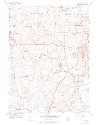
1955 Map of Slocum
USGS Topo · Published 1972About this map
Slocum and the surrounding rural landscape of Washington County appear here in detail following mid-century revisions. The area is characterized by scattered villages and significant institutional footprints, notably the Joseph H Ladd Sch and the State Fish Hatchery. Small crossroad settlements like Liberty and Usquepaug serve as local anchors, while the rail corridor of the Penn Central cuts through the southeastern corner near the village of Slocum.
Find a feature on this map
73 named features on this map. Tap any name to fly to it.
Don’t see what you’re looking for? This feature index may not catch every label — zoom into the map to look around manually.
Map Details
Editions of this 1955 Slocum Map
5 editions found

Other maps of this area

1889 · Charlestown
USGS Topo · 1:62,500

1889 · Newport
USGS Topo · 1:62,500

1890 · Narragansett Bay
USGS Topo · 1:62,500

1890 · Kent
USGS Topo · 1:62,500

1892 · Narragansett Bay
USGS Topo · 1:62,500

1894 · Kent
USGS Topo · 1:62,500

1894 · Newport
USGS Topo · 1:62,500

1904 · Newport
USGS Topo · 1:62,500

1919 · Charlestown
USGS Topo · 1:62,500

1919 · Narragansett Bay
USGS Topo · 1:62,500