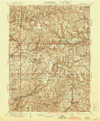
1939 Map of Smicksburg
USGS Topo · Published 1944About this map
Mahoning Creek and its tributary, Little Mahoning Creek, carve a winding path through this corner of Jefferson, Indiana, and Armstrong Counties. The landscape reflects an early 20th-century rural economy defined by the Baltimore And Ohio railroad and local processing points like Mottarns Mill. Mining activity is notably anchored at Sagamore, where Mine No 8 stands as a focal point for local industry.
Find a feature on this map
93 named features on this map. Tap any name to fly to it.
Don’t see what you’re looking for? This feature index may not catch every label — zoom into the map to look around manually.
Map Details
Editions of this 1939 Smicksburg Map
2 editions found

Other maps of this area

1901 · Rural Valley
USGS Topo · 1:62,500

1902 · Indiana
USGS Topo · 1:62,500

1902 · Barnesboro
USGS Topo · 1:62,500

1902 · Elders Ridge
USGS Topo · 1:62,500

1903 · Rural Valley
USGS Topo · 1:62,500

1904 · Barnesboro
USGS Topo · 1:62,500

1904 · Elders Ridge
USGS Topo · 1:62,500

1906 · Clarion
USGS Topo · 1:62,500

1906 · Punxsutawney
USGS Topo · 1:62,500

1907 · Clarion
USGS Topo · 1:62,500