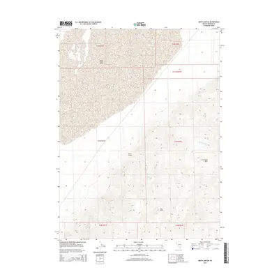
2015 Map of Smith Canyon
USGS Topo · Published 2015About this map
The Smoke Creek Desert dominates the northwestern portion of this quadrangle, transitioning into the steep, rising contours of the Fox Range. This 2015 survey illustrates the stark divide between the expansive desert flat and the complex topography of Smith Canyon. The drainage patterns in the eastern half are defined by the Cottonwood Cr, which flows out of the Cottonwood Basin. The map provides a high-resolution view of this corner of Washoe County, where the desert floor meets the rugged western slopes of the range, offering a precise look at the landforms and township boundaries that define this part of the Nevada interior.
Find a feature on this map
12 named features on this map. Tap any name to fly to it.
Don’t see what you’re looking for? This feature index may not catch every label — zoom into the map to look around manually.
Map Details
Editions of this 2015 Smith Canyon Map
This is the sole edition of this map. No revisions or reprints were ever made.
Other maps of this area

1886 · Granite Range
USGS Topo · 1:250,000

1894 · Granite Range
USGS Topo · 1:250,000

1955 · Lovelock
USGS Topo · 1:250,000

1959 · Lovelock
USGS Topo · 1:250,000

1964 · Gerlach
USGS Topo · 1:62,500

1964 · Kumiva Peak
USGS Topo · 1:62,500

1965 · Fox Range
USGS Topo · 1:62,500

1980 · Hog Spring
USGS Topo · 1:24,000

1980 · Wall Spring
USGS Topo · 1:24,000

1980 · Smith Canyon
USGS Topo · 1:24,000