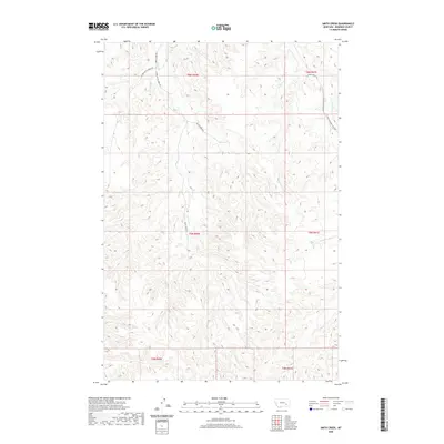
2020 Map of Smith Creek
USGS Topo · Published 2020About this map
Smith Cr carves through this portion of Rosebud County, forming a drainage network that defines the local ranching landscape. The terrain is structured by a series of long ridges and valleys, with Long Prong and Slaughterhouse Cr providing secondary drainage to the east. This 2020 survey reveals a remote area primarily accessed by unpaved routes like Smith Creek Rd and the W Fork Smith Creek Rd, reflecting the traditional land use patterns of Big Sky country. The presence of Flying X Ranch Ln underscores the area's ongoing agricultural and ranching heritage. These roads follow the natural contours of the creeks, illustrating how the watercourses dictate human movement and property boundaries in this Montana interior.
Find a feature on this map
15 named features on this map. Tap any name to fly to it.
Don’t see what you’re looking for? This feature index may not catch every label — zoom into the map to look around manually.
Map Details
Editions of this 2020 Smith Creek Map
This is the sole edition of this map. No revisions or reprints were ever made.
Other maps of this area

1954 · Forsyth
USGS Topo · 1:250,000

1957 · Forsyth
USGS Topo · 1:250,000

1958 · Forsyth
USGS Topo · 1:250,000

1968 · Orinoco
USGS Topo · 1:24,000

1968 · Nichols
USGS Topo · 1:24,000

1968 · Forsyth
USGS Topo · 1:24,000

1971 · Griffin Coulee NE
USGS Topo · 1:24,000

1971 · Smith Creek NE
USGS Topo · 1:24,000
1971 · Smith Creek
USGS Topo · 1:24,000
1971 · Mc Kerlich Creek
USGS Topo · 1:24,000