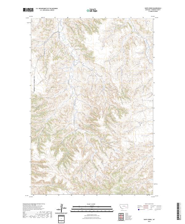
2024 Map of Smith Creek
USGS Topo · Published 2024About this map
Smith Creek winds through the heart of this Rosebud County landscape, defining the local geography alongside tributaries like Long Prong and Slaughterhouse Creek. This 2024 map documents the remote ranching and grazing country of eastern Montana, where accessibility is defined by a sparse network of gravel and unimproved roads. The survey emphasizes the Public Land Survey System (PLSS) grid, showing the township and range divisions such as t6n r40e and t5n r41e that continue to dictate land ownership and management in the modern era. Navigation through this drainage system is facilitated by Smith Creek Rd, which tracks the main waterway before splitting into the W Fork Smith Creek Rd and E Fork Smith Creek Rd. These routes provide the primary access to the isolated draws and ridgelines that characterize this portion of the Big Sky State.
Find a feature on this map
12 named features on this map. Tap any name to fly to it.
Don’t see what you’re looking for? This feature index may not catch every label — zoom into the map to look around manually.
Map Details
Editions of this 2024 Smith Creek Map
This is the sole edition of this map. No revisions or reprints were ever made.
Other maps of this area

1954 · Forsyth
USGS Topo · 1:250,000

1957 · Forsyth
USGS Topo · 1:250,000

1958 · Forsyth
USGS Topo · 1:250,000

1968 · Orinoco
USGS Topo · 1:24,000

1968 · Nichols
USGS Topo · 1:24,000

1968 · Forsyth
USGS Topo · 1:24,000

1971 · Griffin Coulee NE
USGS Topo · 1:24,000

1971 · Smith Creek NE
USGS Topo · 1:24,000
1971 · Smith Creek
USGS Topo · 1:24,000
1971 · Mc Kerlich Creek
USGS Topo · 1:24,000