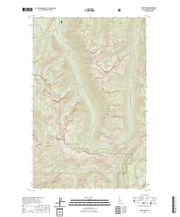
2024 Map of Smith Peak
USGS Topo · Published 2024About this map
Kaniksu National Forest defines this high-elevation landscape in Boundary County, where the Selkirk Mountains dominate the terrain. The 2024 survey detail reveals a complex network of alpine trails and peaks, centered around Smith Peak and the dramatic geological formations of The Lions Head. The map serves as a contemporary guide to this protected wilderness, showing the established path of the Pacific Northwest National Scenic Trail as it traverses Lions Head Ridge and passes through Long Canyon Pass. Numerous small water bodies, including Smith Lake, Cutoff Lake, and Myrtle Lake, are tucked between prominent heights like West Fork Mountain and Abandon Mountain. This edition captures the modern conservation and recreation infrastructure of northern Idaho, from the Canyon Creek National Recreation Trail to the remote drainages of Smith Creek and Lion Creek.
Find a feature on this map
34 named features on this map. Tap any name to fly to it.
Don’t see what you’re looking for? This feature index may not catch every label — zoom into the map to look around manually.
Map Details
Editions of this 2024 Smith Peak Map
This is the sole edition of this map. No revisions or reprints were ever made.
Other maps of this area

1911 · Priest Lake
USGS Topo · 1:250,000

1913 · Priest Lake
USGS Topo · 1:250,000

1958 · Sandpoint
USGS Topo · 1:250,000

1963 · Sandpoint
USGS Topo · 1:250,000

1967 · Priest Lake NE
USGS Topo · 1:24,000

1967 · The Wigwams
USGS Topo · 1:24,000
1967 · Roman Nose
USGS Topo · 1:24,000

1968 · Smith Falls
USGS Topo · 1:24,000

1969 · Grass Mountain
USGS Topo · 1:24,000
1969 · Caribou Creek
USGS Topo · 1:24,000