
1968 Map of Smith Falls
USGS Topo · Published 1971About this map
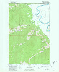
The Canada United States border defines the northern limit of this late 1960s survey, where the rugged slopes of the Kaniksu National Forest descend into the Kootenai Valley. The landscape is dominated by high summits such as Italian Peak, Parker Peak, and Eneas Peak, which overlook a network of drainage systems including Long Canyon Creek and Smith Creek. Along the eastern edge, the meandering Kootenai River provides a vital corridor for low-lying activity, featuring several pumps and storage infrastructure. Evidence of forest management and early resource extraction appears at the Smith Creek Guard Station and a nearby Gravel Pit. The map captures the remote character of Boundary County, where the West Side Road serves as a primary transit artery alongside the dramatic Smith Falls, illustrating the region's historical reliance on river-and-forest geography.
Find a feature on this map
21 named features on this map. Tap any name to fly to it.
Don’t see what you’re looking for? This feature index may not catch every label — zoom into the map to look around manually.
Map Details
Editions of this 1968 Smith Falls Map
2 editions found
Other maps of this area

1911 · Priest Lake
USGS Topo · 1:250,000

1913 · Priest Lake
USGS Topo · 1:250,000

1958 · Sandpoint
USGS Topo · 1:250,000

1963 · Sandpoint
USGS Topo · 1:250,000

1965 · Farnham Peak
USGS Topo · 1:24,000

1965 · Copeland
USGS Topo · 1:24,000

1969 · Pyramid Peak
USGS Topo · 1:24,000
1969 · Shorty Peak
USGS Topo · 1:24,000
1969 · Smith Peak
USGS Topo · 1:24,000
1983 · Bonners Ferry
USGS Topo · 1:100,000