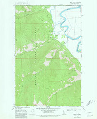
1968 Map of Smith Falls
USGS Topo · Published 1981About this map
The Kootenai River snakes through the northeast corner of this Boundary County landscape, marking a sharp transition between the river valley and the steep heights of the Kaniksu National Forest. In the late 1960s, the riverside area supported infrastructure such as a Landing Strip, Storage Bins, and several pumping stations, reflecting the agricultural and transport needs along the river's edge. To the west, the terrain rises into high peaks, including Italian Peak and Parker Peak, separated by deep drainages like Long Canyon. The Smith Creek Guard Station serves as a lonely outpost for forest management near the base of the mountains, while the eponymous Smith Falls is located just upstream where Smith Creek descends from the high country. The international boundary between the United States and Canada runs along the northern edge of this survey, highlighting the remote, borderland character of this Idaho panhandle region.
Find a feature on this map
24 named features on this map. Tap any name to fly to it.
Don’t see what you’re looking for? This feature index may not catch every label — zoom into the map to look around manually.
Map Details
Editions of this 1968 Smith Falls Map
2 editions found
Other maps of this area

1911 · Priest Lake
USGS Topo · 1:250,000

1913 · Priest Lake
USGS Topo · 1:250,000

1958 · Sandpoint
USGS Topo · 1:250,000

1963 · Sandpoint
USGS Topo · 1:250,000

1965 · Farnham Peak
USGS Topo · 1:24,000

1965 · Copeland
USGS Topo · 1:24,000

1968 · Smith Falls
USGS Topo · 1:24,000

1969 · Pyramid Peak
USGS Topo · 1:24,000
1969 · Shorty Peak
USGS Topo · 1:24,000
1969 · Smith Peak
USGS Topo · 1:24,000