
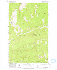
1969 Map of Pyramid Peak
USGS Topo · Published 1971About this map
Kaniksu National Forest defines this high-elevation landscape in Boundary County, Idaho, where the Selkirk Mountains rise to distinctive points such as Pyramid Peak and Fisher Peak. This late-1960s survey documents a network of high-mountain waters, including the glacially-fed Big Fisher Lake, Pyramid Lake, and Trout Lake, alongside the alpine cluster of Ball Lakes. The terrain is characterized by a high degree of vertical relief, with Farnham Ridge and Cascade Ridge forming natural dividers for the numerous drainages that feed the Kootenai River basin. Human access during this era is marked by a sparse network of infrastructure, primarily composed of a Pack Trail, Jeep Trail, and the West Side Road. The southern portion of the map is dedicated to the Myrtle Creek State Game Preserve, indicating the region's historical importance for wildlife management and habitat protection.
Find a feature on this map
38 named features on this map. Tap any name to fly to it.
Don’t see what you’re looking for? This feature index may not catch every label — zoom into the map to look around manually.
Map Details
Editions of this 1969 Pyramid Peak Map
2 editions found
Other maps of this area

1911 · Priest Lake
USGS Topo · 1:250,000

1913 · Priest Lake
USGS Topo · 1:250,000

1958 · Sandpoint
USGS Topo · 1:250,000

1963 · Sandpoint
USGS Topo · 1:250,000

1965 · Farnham Peak
USGS Topo · 1:24,000

1965 · Moravia
USGS Topo · 1:24,000

1965 · Copeland
USGS Topo · 1:24,000

1967 · The Wigwams
USGS Topo · 1:24,000
1967 · Roman Nose
USGS Topo · 1:24,000

1968 · Smith Falls
USGS Topo · 1:24,000