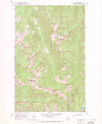
1969 Map of Smith Peak
USGS Topo · Published 1971About this map
Kaniksu National Forest defines this high-elevation landscape in Boundary County, where 1960s mapping efforts captured a network of mountain peaks and alpine lakes. Notable summits like Smith Peak and The Lions Head punctuate the ridgelines, which are crossed by a rugged Pack Trail connecting remote drainage basins. The presence of the West Fork Cabin suggests the area's role in forest management and backcountry recreation during this era.
Find a feature on this map
24 named features on this map. Tap any name to fly to it.
Don’t see what you’re looking for? This feature index may not catch every label — zoom into the map to look around manually.
Map Details
Editions of this 1969 Smith Peak Map
2 editions found
Other maps of this area

1911 · Priest Lake
USGS Topo · 1:250,000

1913 · Priest Lake
USGS Topo · 1:250,000

1958 · Sandpoint
USGS Topo · 1:250,000

1963 · Sandpoint
USGS Topo · 1:250,000

1967 · Priest Lake NE
USGS Topo · 1:24,000

1967 · The Wigwams
USGS Topo · 1:24,000
1967 · Roman Nose
USGS Topo · 1:24,000

1968 · Smith Falls
USGS Topo · 1:24,000

1969 · Grass Mountain
USGS Topo · 1:24,000
1969 · Caribou Creek
USGS Topo · 1:24,000