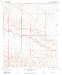
1967 Map of Smith Peak NE
USGS Topo · Published 1985About this map
Date Creek winds through this arid landscape of western Arizona, marking a significant drainage route that historically dictated travel and survival in the region. Mapping conducted by the Geological Survey during the late 1960s captures a terrain defined by its water sources and rugged transit routes, spanning the boundary between Yuma Co and Yavapai Co. This remote corner of the state relies on intermittent water features like Bullard Wash and Miller Wash for its geography.
Find a feature on this map
8 named features on this map. Tap any name to fly to it.
Don’t see what you’re looking for? This feature index may not catch every label — zoom into the map to look around manually.
Map Details
Editions of this 1967 Smith Peak NE Map
2 editions found
Other maps of this area

1923 · Signal
USGS Topo · 1:250,000

1942 · Signal
USGS Topo · 1:250,000

1950 · Prescott
USGS Topo · 1:250,000

1954 · Prescott
USGS Topo · 1:250,000

1958 · Prescott
USGS Topo · 1:250,000

1959 · Prescott
USGS Topo · 1:250,000

1960 · Prescott
USGS Topo · 1:250,000

1965 · Prescott
USGS Topo · 1:250,000
1967 · Smith Peak
USGS Topo · 1:24,000
1967 · E.C.P. Peak
USGS Topo · 1:24,000