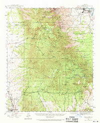
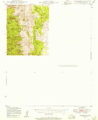
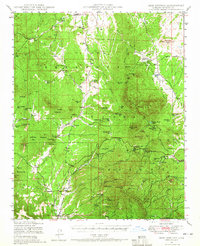
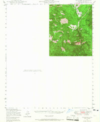
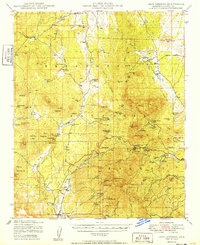
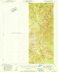
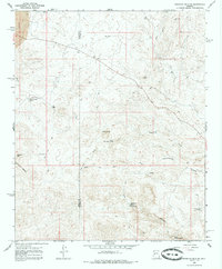
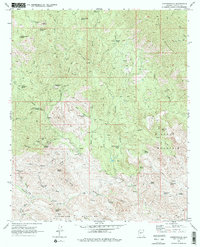
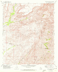
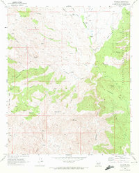
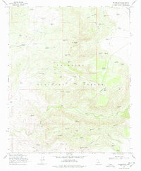
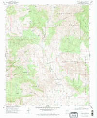
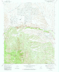
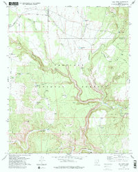
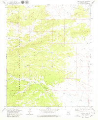
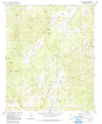
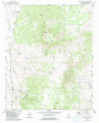
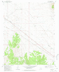
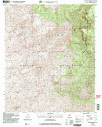
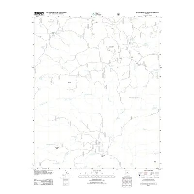
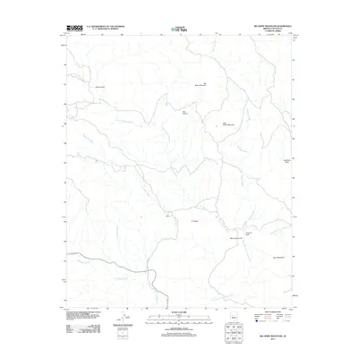
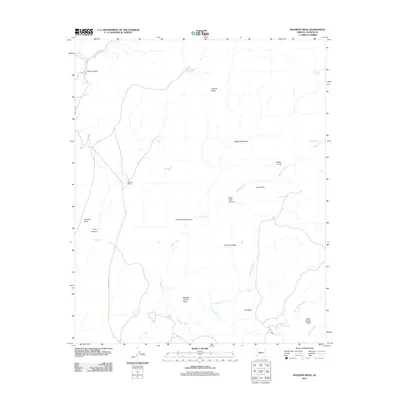
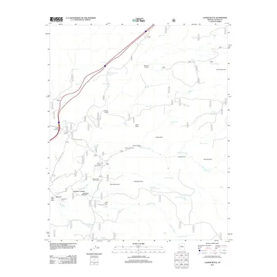
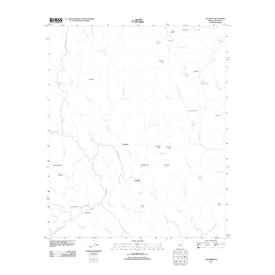
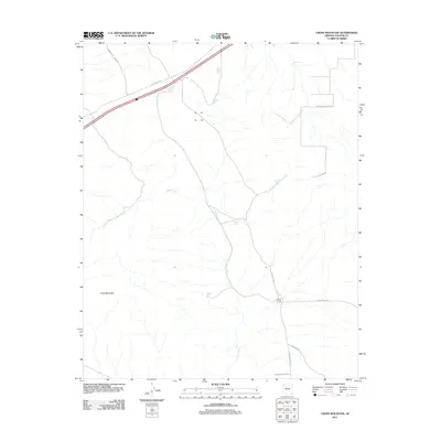
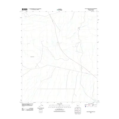
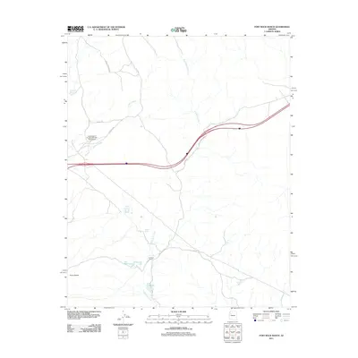
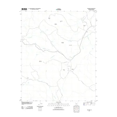
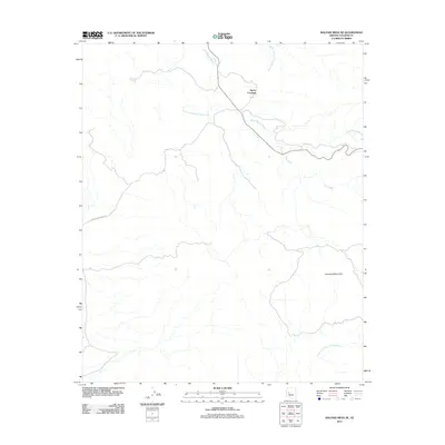
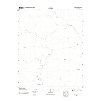
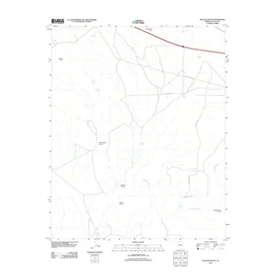
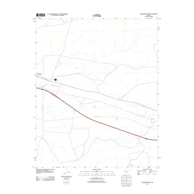
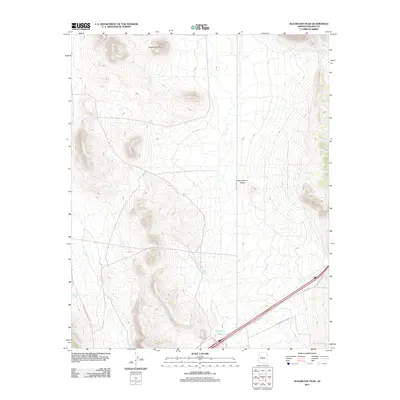
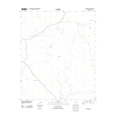
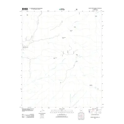
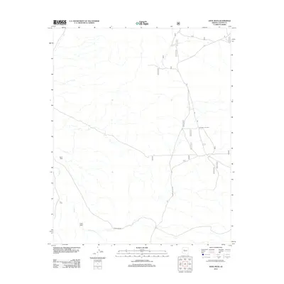
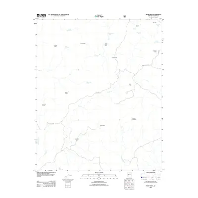
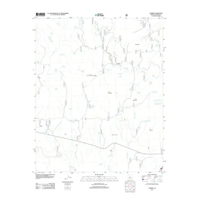
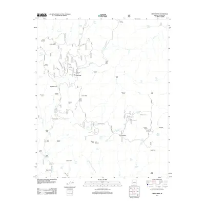
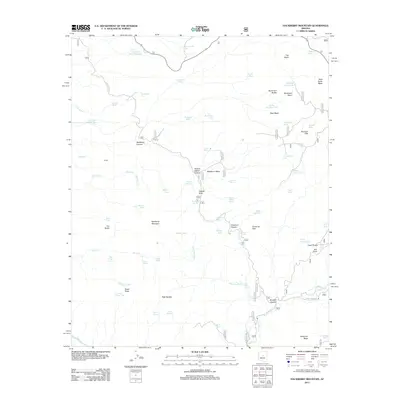
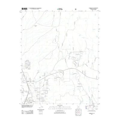
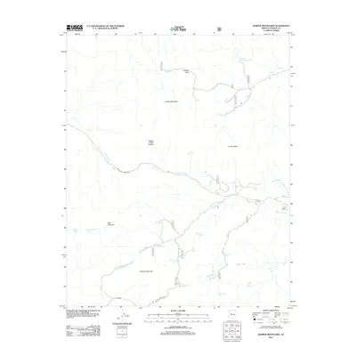
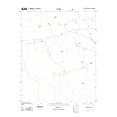
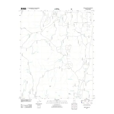
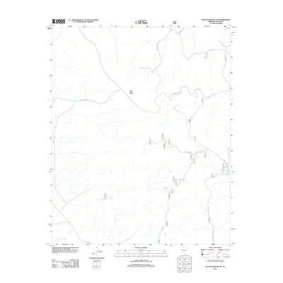
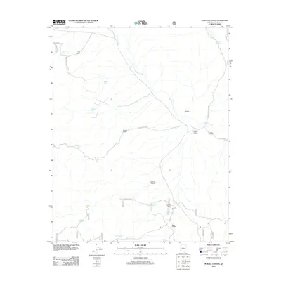
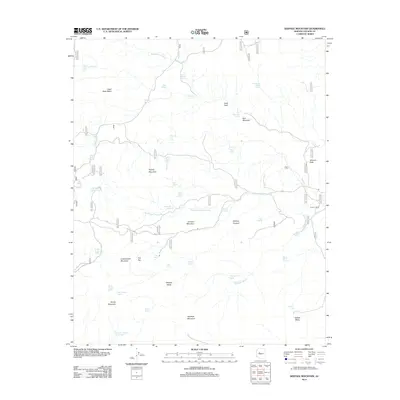
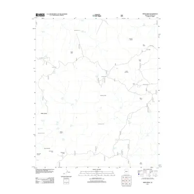
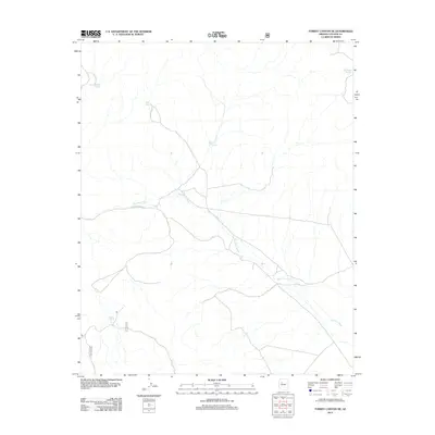
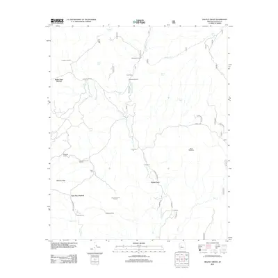
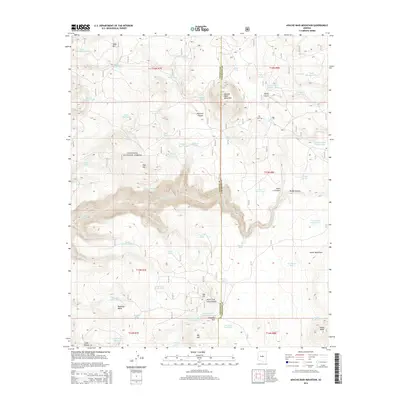
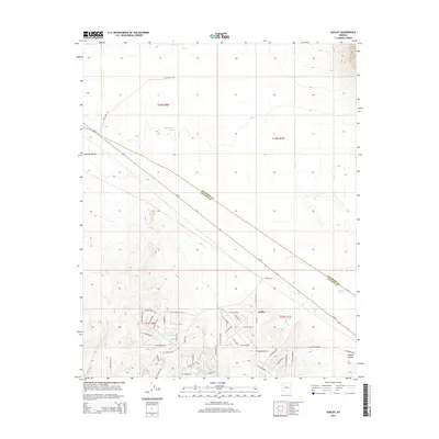
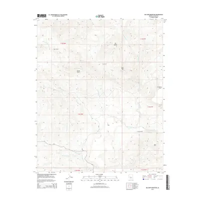
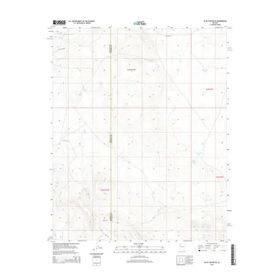
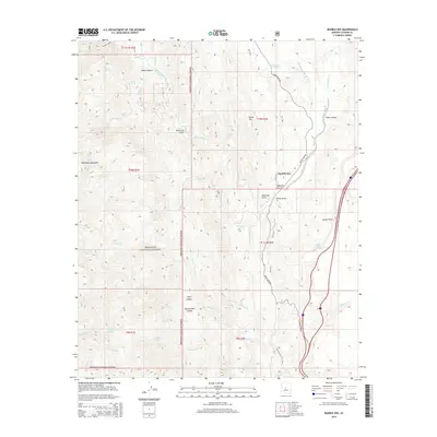
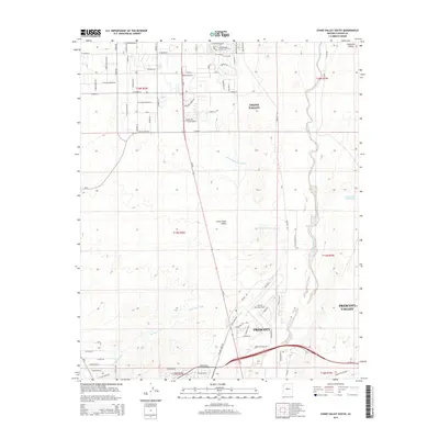
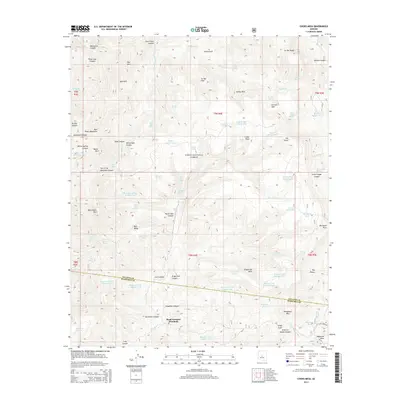
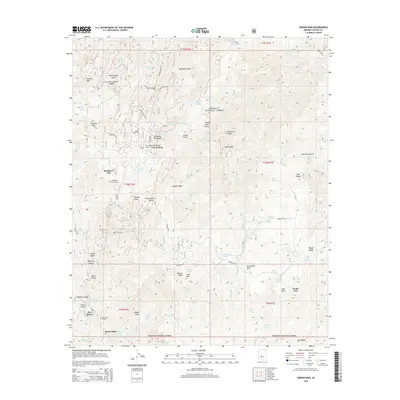
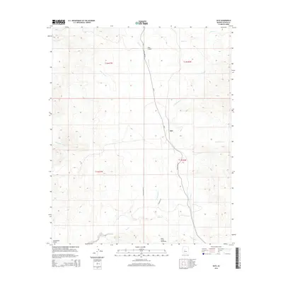
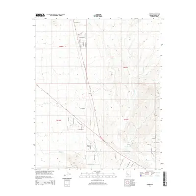
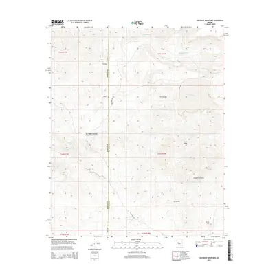
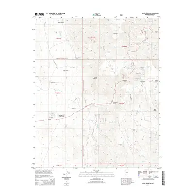
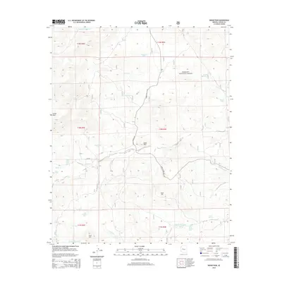
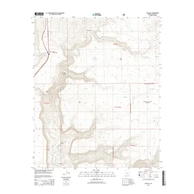
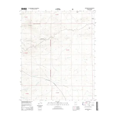
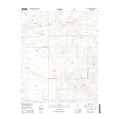
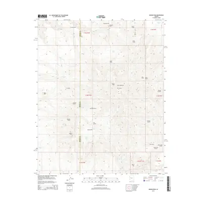
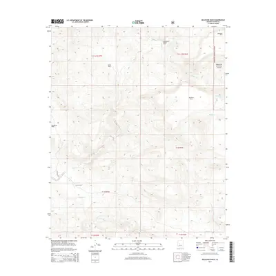
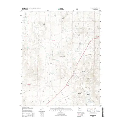
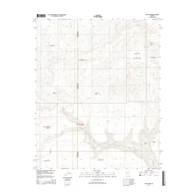
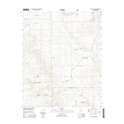
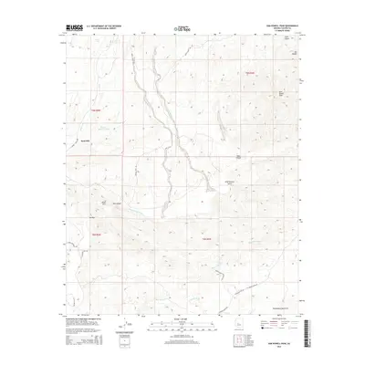
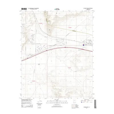
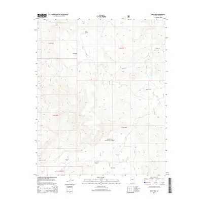
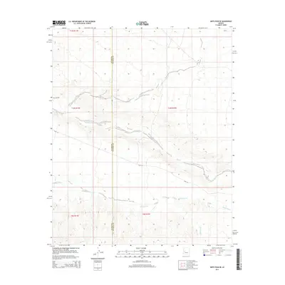
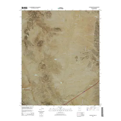
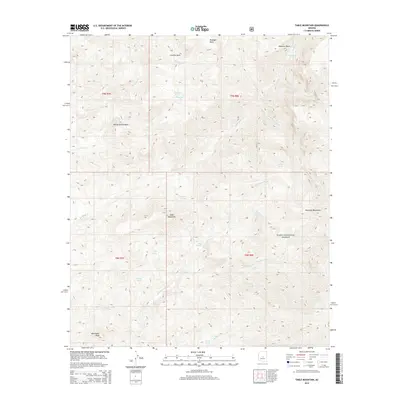
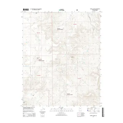
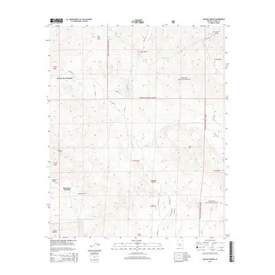
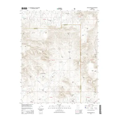
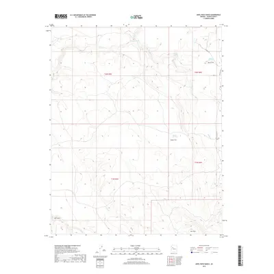
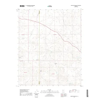
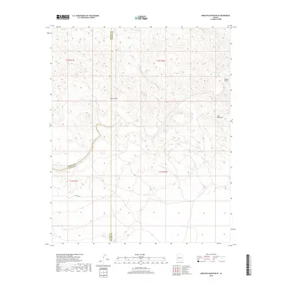
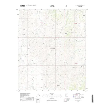
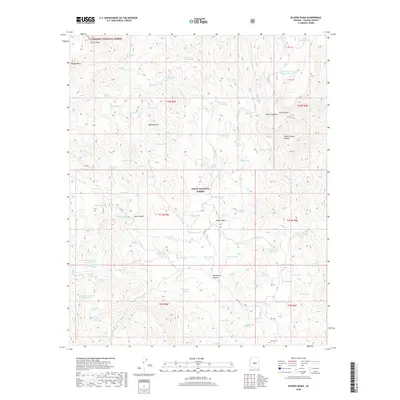
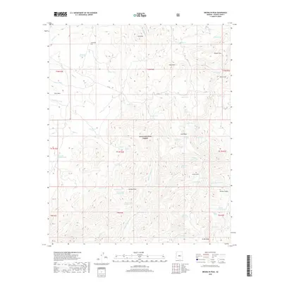
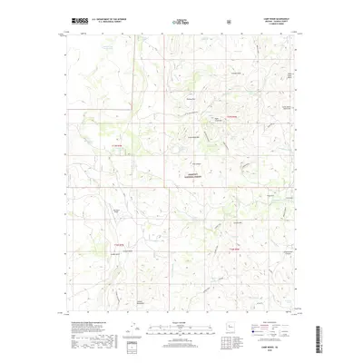
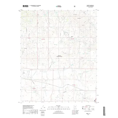
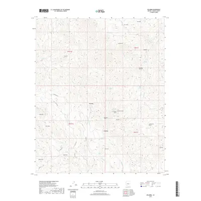
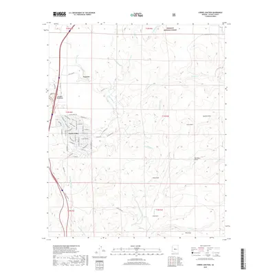
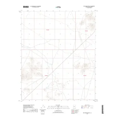
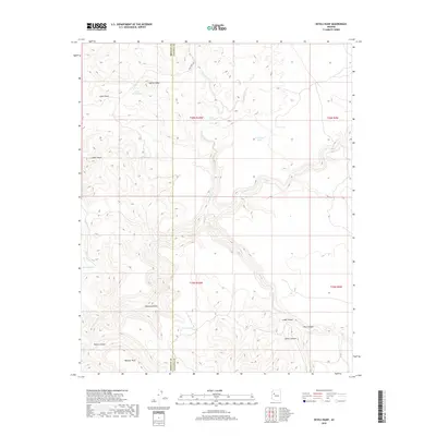
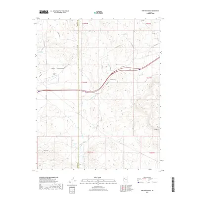
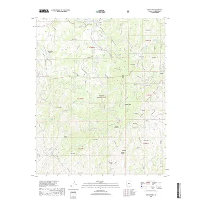
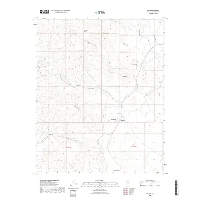
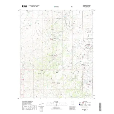
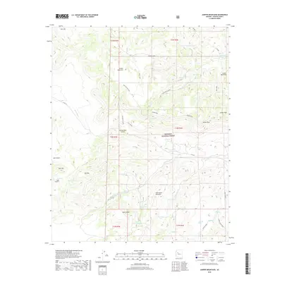
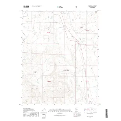
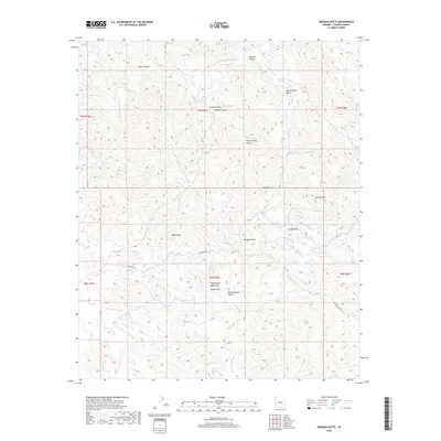
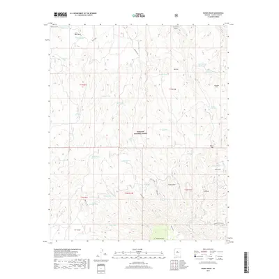
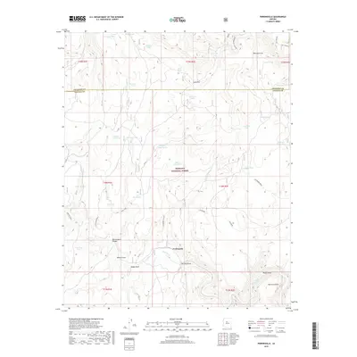
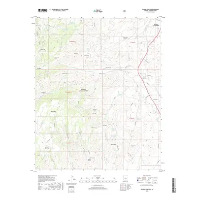
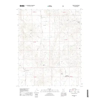
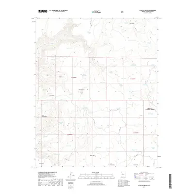
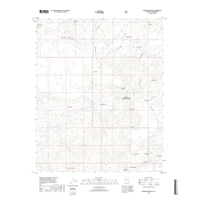
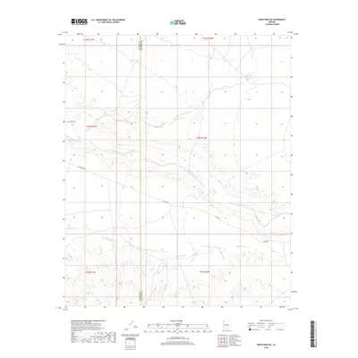
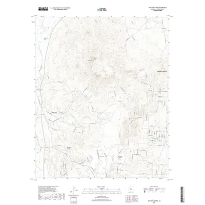
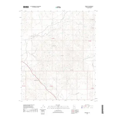
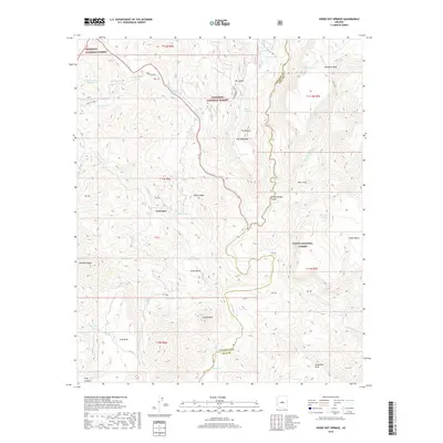
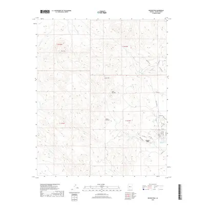
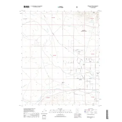
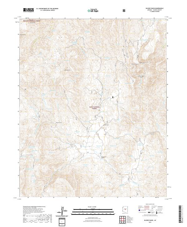
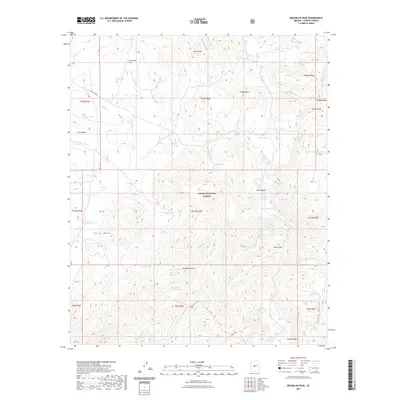
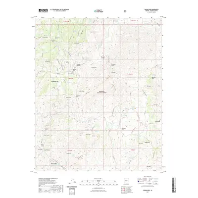
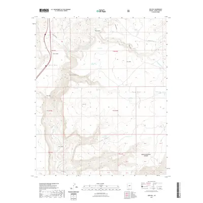
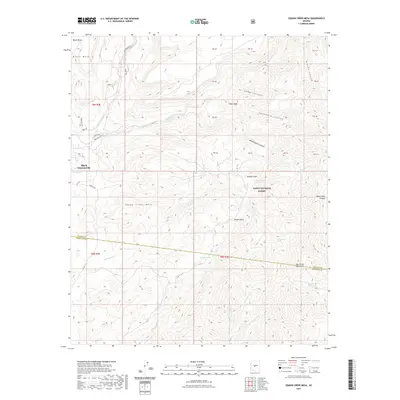
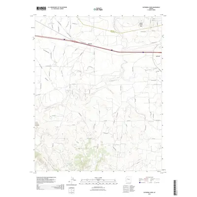
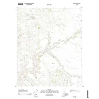
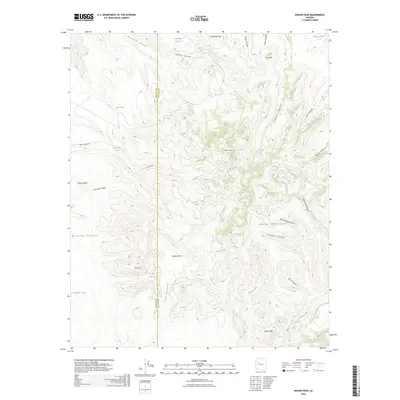
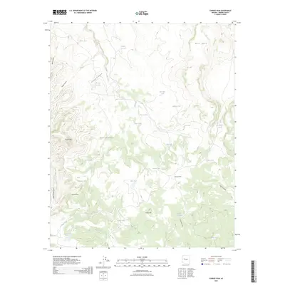
1967 Map of Smith Peak NE
USGS Topo · Published 1969About this map
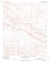
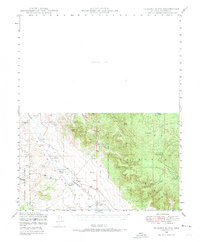
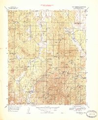
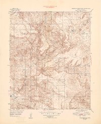
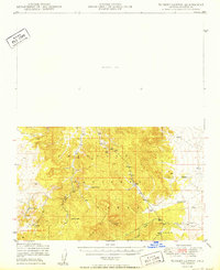
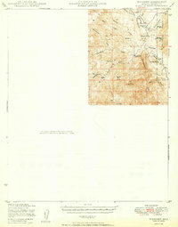
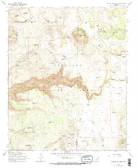
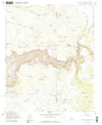
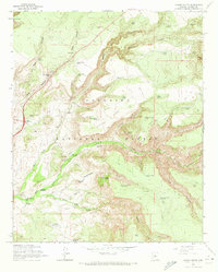
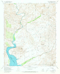
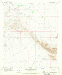
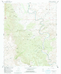
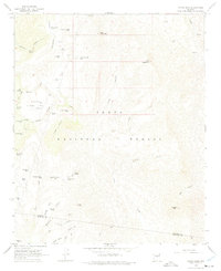
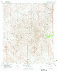
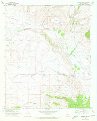
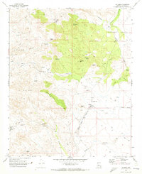
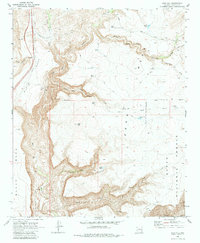
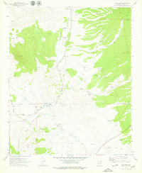
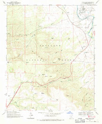
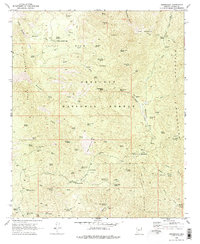
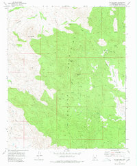
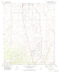
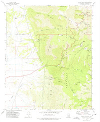
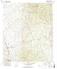
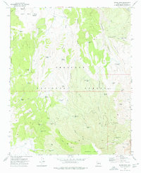
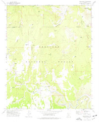
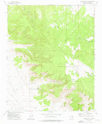
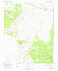
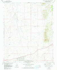
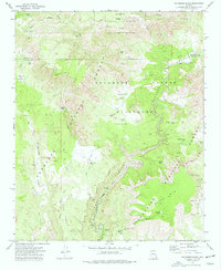
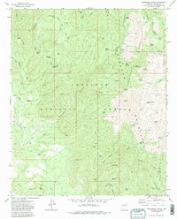
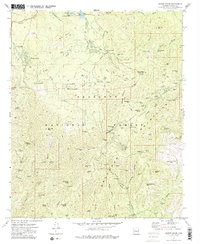
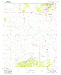
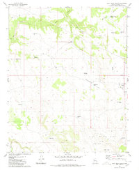
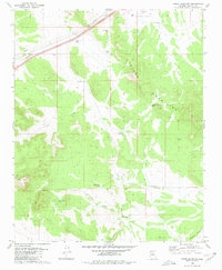
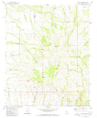
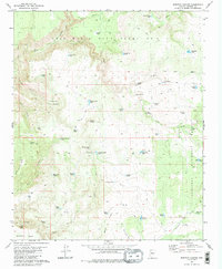
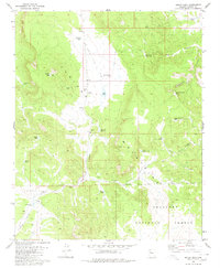
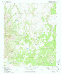
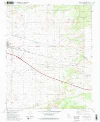
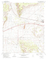
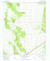
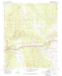
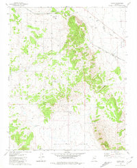
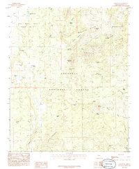
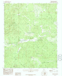
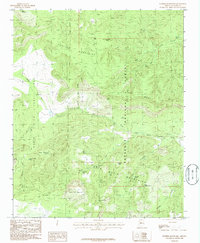
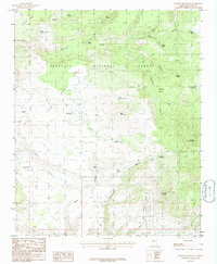
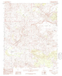
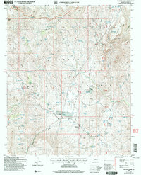
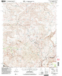
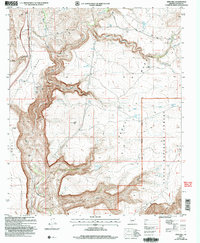
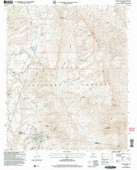
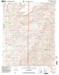
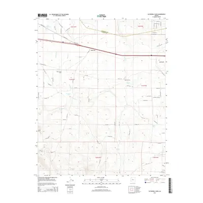
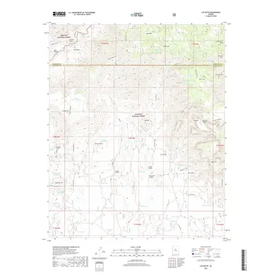
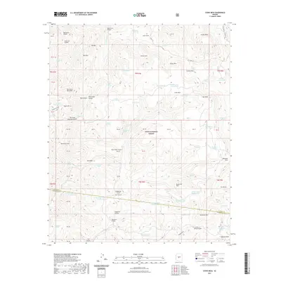
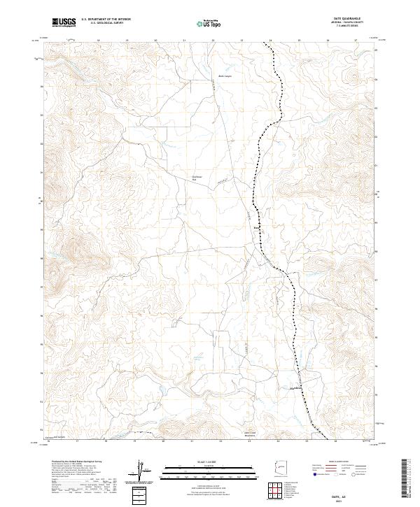
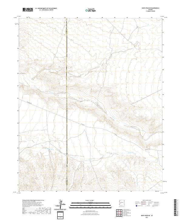
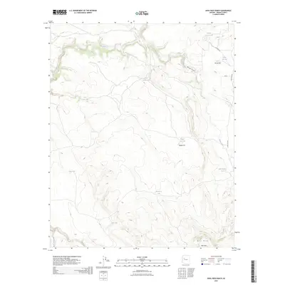
The Yuma Co Yavapai Co boundary line divides this arid landscape of western Arizona as it appeared in the late 1960s. The topography is defined by the extensive drainage systems of Date Creek and Bullard Wash, which weave through the terrain alongside Miller Wash. In an environment where water sources were critical for ranching and travel, the survey identifies several points of infrastructure, including the Date Creek Well, Round Tank Well, and a simple Well further east. Transportation across this desert expanse was limited to rugged paths such as the Alamo Road and a network of unnamed Jeep Trails. This survey provides a record of the remote back-country before modern development changed the accessibility of the borderlands between Yuma and Yavapai counties.
Find a feature on this map
9 named features on this map. Tap any name to fly to it.
Don’t see what you’re looking for? This feature index may not catch every label — zoom into the map to look around manually.
Map Details
Editions of this 1967 Smith Peak NE Map
2 editions found
Historical Maps of Yavapai County Through Time
694 maps found
1903 Bradshaw Mountains
Yavapai County, AZ
1929 Turret Peak
Yavapai County, AZ
1933 Turret Peak
Yavapai County, AZ
1944 Mingus Mtn
Yavapai County, AZ
1947 Bumblebee
Yavapai County, AZ
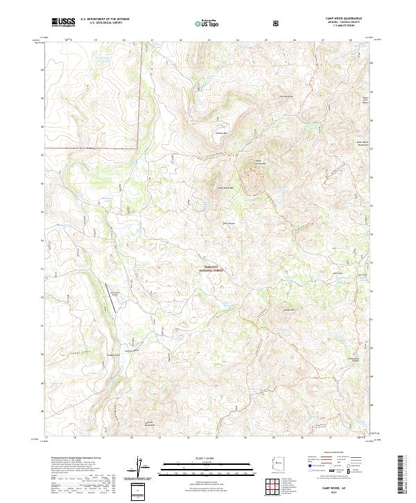
1947 Camp Wood
Yavapai County, AZ
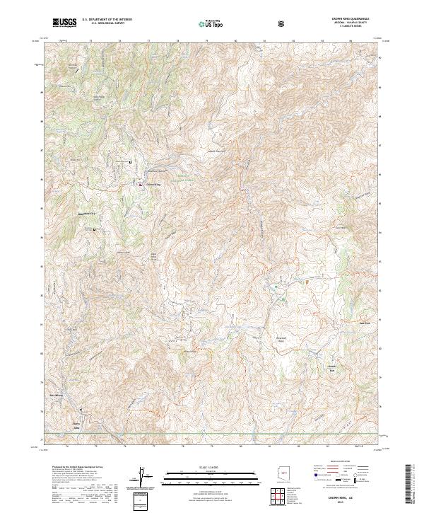
1947 Crown King
Yavapai County, AZ
1947 Iron Springs
Yavapai County, AZ
1947 Kirkland
Yavapai County, AZ
1947 Mingus Mtn
Yavapai County, AZ
1947 Mt. Union
Yavapai County, AZ
1947 Picacho Butte
Yavapai County, AZ
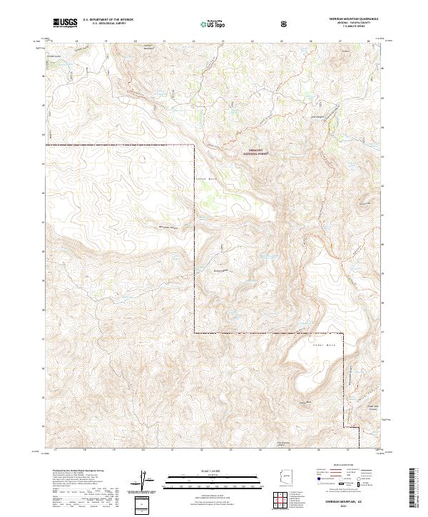
1947 Sheridan Mountain
Yavapai County, AZ
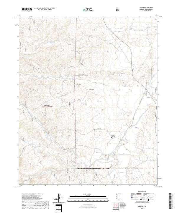
1947 Simmons
Yavapai County, AZ
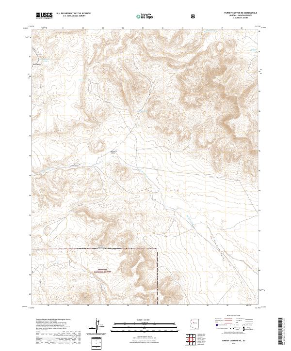
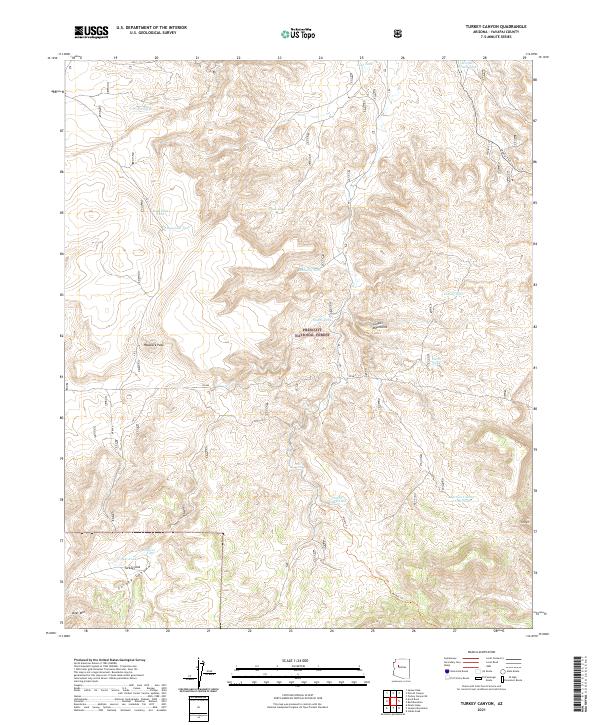
1947 Turkey Canyon
Yavapai County, AZ
1947 Wagoner
Yavapai County, AZ
1948 Bumblebee
Yavapai County, AZ
1948 Camp Wood
Yavapai County, AZ
1948 Crown King
Yavapai County, AZ
1948 Iron Springs
Yavapai County, AZ
1948 Kirkland
Yavapai County, AZ
1948 Mt. Union
Yavapai County, AZ
1948 Picacho Butte
Yavapai County, AZ
1948 Sheridan Mountain
Yavapai County, AZ
1948 Simmons
Yavapai County, AZ
1948 Wagoner
Yavapai County, AZ
1949 Camp Wood
Yavapai County, AZ
1949 Iron Springs
Yavapai County, AZ
1949 Mt. Union
Yavapai County, AZ
1950 Bumblebee
Yavapai County, AZ
1950 Crown King
Yavapai County, AZ
1950 Kirkland
Yavapai County, AZ
1950 Picacho Butte
Yavapai County, AZ
1950 Sheridan Mountain
Yavapai County, AZ
1950 Simmons
Yavapai County, AZ
1950 Turkey Canyon
Yavapai County, AZ
1950 Wagoner
Yavapai County, AZ
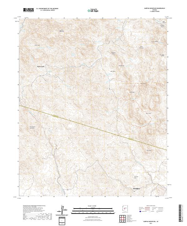
1964 Garfias Mountain
Yavapai County, AZ
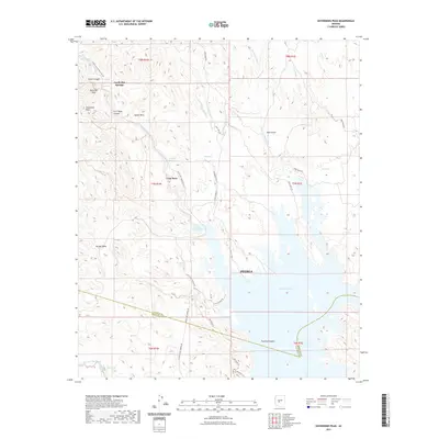
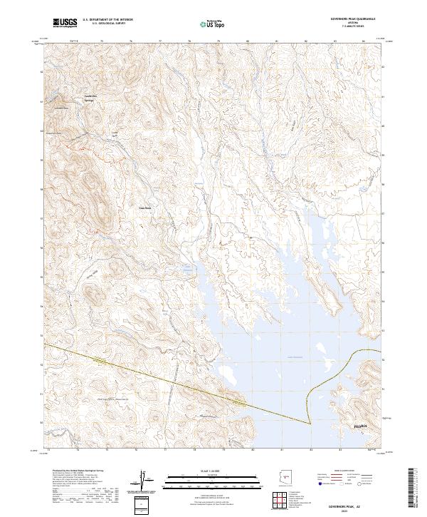
1964 Governors Peak
Yavapai County, AZ
1965 Apache Maid Mtn
Yavapai County, AZ
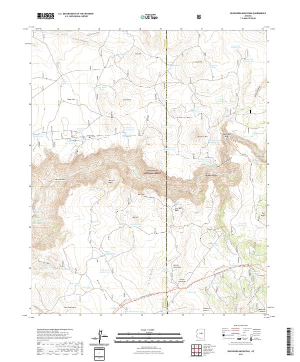
1965 Buckhorn Mountain
Yavapai County, AZ
1965 Casner Butte
Yavapai County, AZ
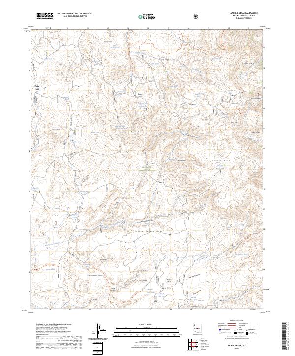
1967 Arnold Mesa
Yavapai County, AZ
1967 Arrastra Mtn NE
Yavapai County, AZ
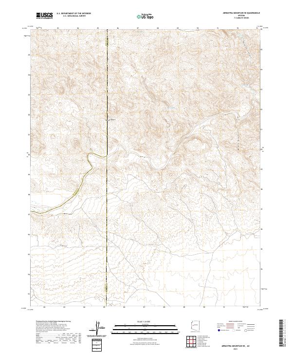
1967 Arrastra Mtn SE
Yavapai County, AZ
1967 Bloody Basin
Yavapai County, AZ
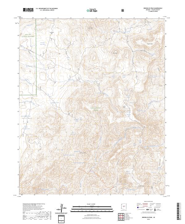
1967 Brooklyn Peak
Yavapai County, AZ
1967 Chalk Mountain
Yavapai County, AZ
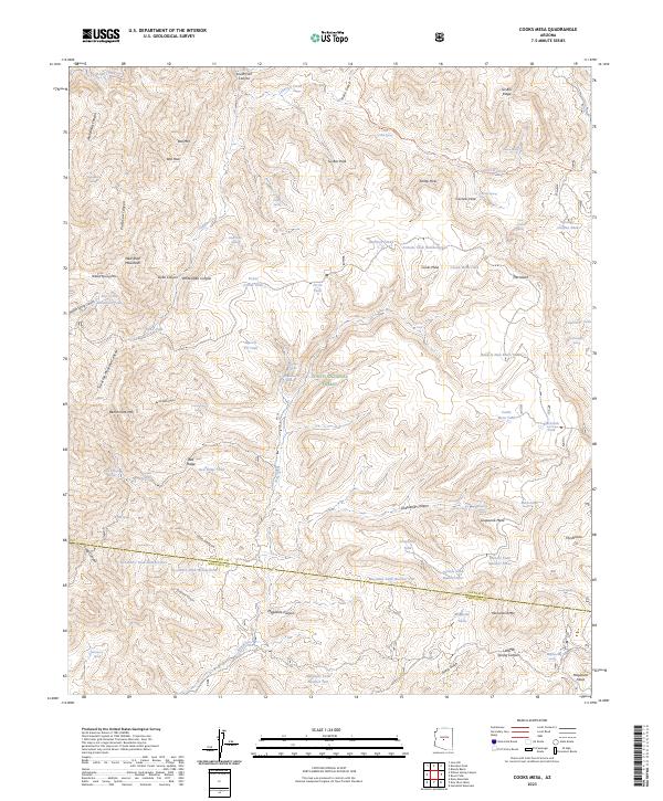
1967 Cooks Mesa
Yavapai County, AZ
1967 Date Creek Ranch NW
Yavapai County, AZ
1967 Date Creek Ranch SE
Yavapai County, AZ
1967 Date Creek Ranch SW
Yavapai County, AZ
1967 Date Creek Ranch
Yavapai County, AZ
1967 Dugas
Yavapai County, AZ
1967 Hackberry Mtn.
Yavapai County, AZ
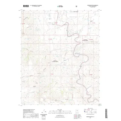
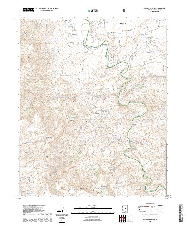
1967 Horner Mtn
Yavapai County, AZ
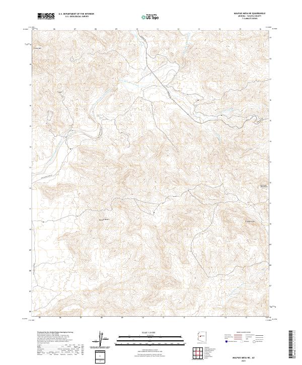
1967 Malpais Mesa NE
Yavapai County, AZ
1967 Malpais Mesa SW
Yavapai County, AZ
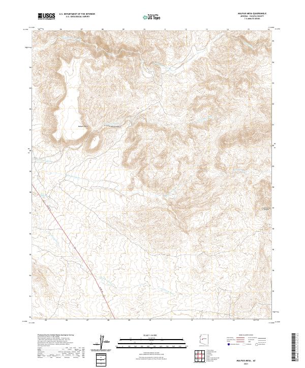
1967 Malpais Mesa
Yavapai County, AZ
1967 Rover Peak
Yavapai County, AZ
1967 Smith Peak NE
Yavapai County, AZ
1967 Smith Peak
Yavapai County, AZ
1967 Table Mountain
Yavapai County, AZ
1967 Thorn Peak
Yavapai County, AZ
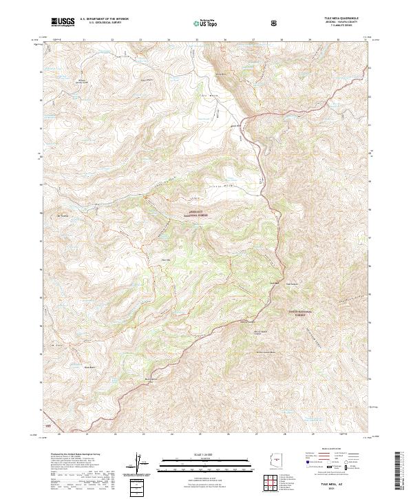
1967 Tule Mesa
Yavapai County, AZ
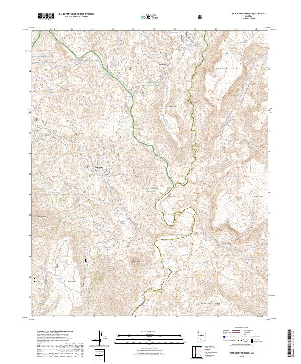
1967 Verde Hot Springs
Yavapai County, AZ
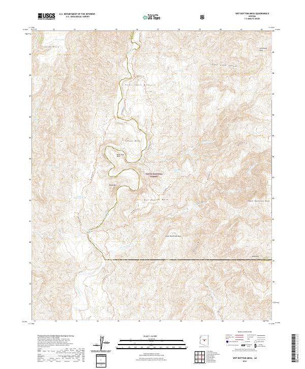
1967 Wet Bottom Mesa
Yavapai County, AZ
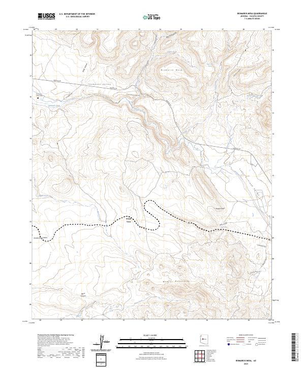
1969 Bismarck Mesa
Yavapai County, AZ
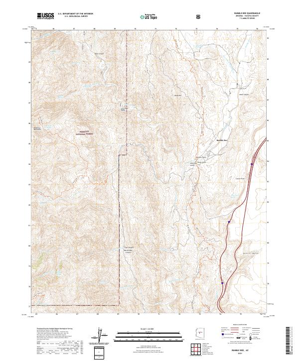
1969 Bumble Bee
Yavapai County, AZ
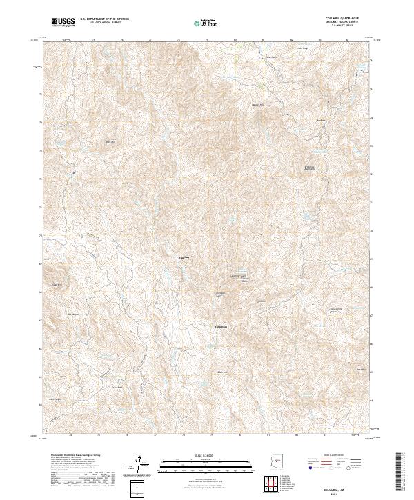
1969 Columbia
Yavapai County, AZ
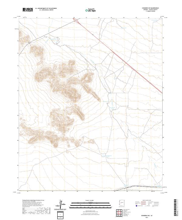
1969 Congress SW
Yavapai County, AZ
1969 Copperopolis
Yavapai County, AZ
1969 Crown King
Yavapai County, AZ
1969 Date
Yavapai County, AZ
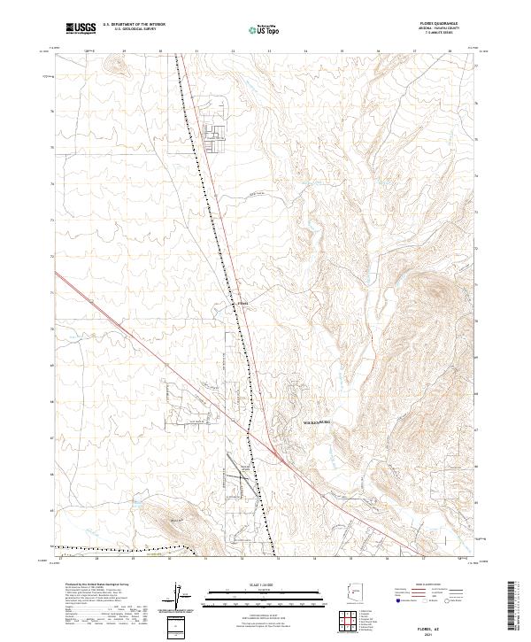
1969 Flores
Yavapai County, AZ
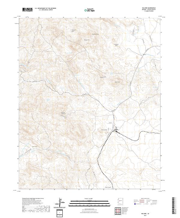
1969 Hillside
Yavapai County, AZ
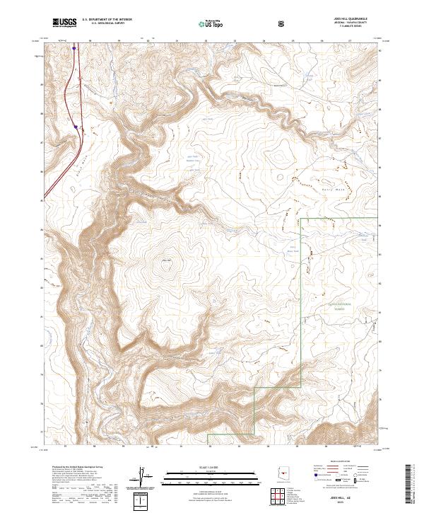
1969 Joes Hill
Yavapai County, AZ
1969 Kirkland
Yavapai County, AZ
1969 Middle Verde
Yavapai County, AZ
1969 Minnehaha
Yavapai County, AZ
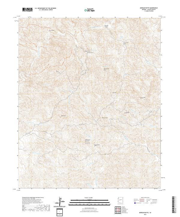
1969 Morgan Butte
Yavapai County, AZ
1969 O'Neill Pass
Yavapai County, AZ
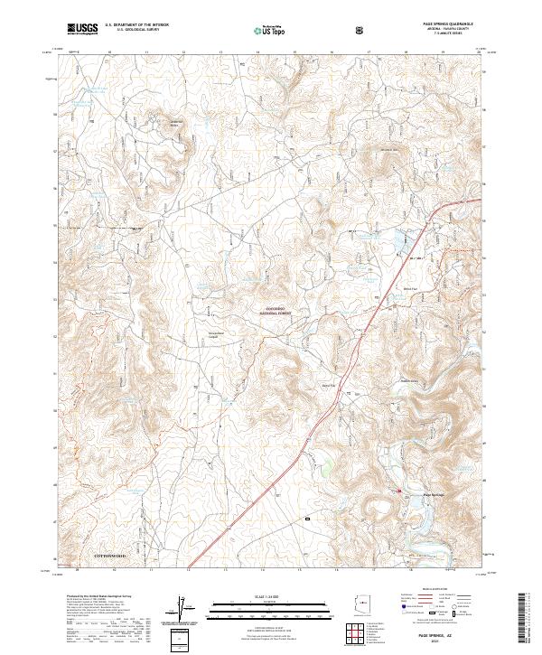
1969 Page Springs
Yavapai County, AZ

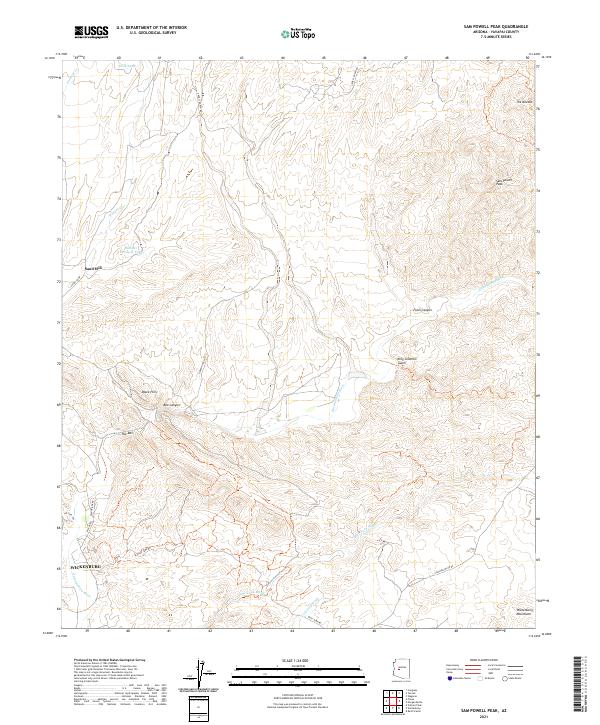
1969 Sam Powell Peak
Yavapai County, AZ
1969 Squaw Creek Mesa
Yavapai County, AZ
1969 Wagoner
Yavapai County, AZ
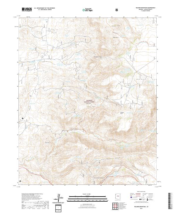
1969 Walker Mtn.
Yavapai County, AZ
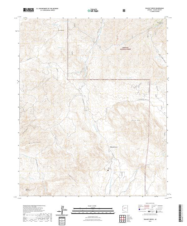
1969 Walnut Grove
Yavapai County, AZ
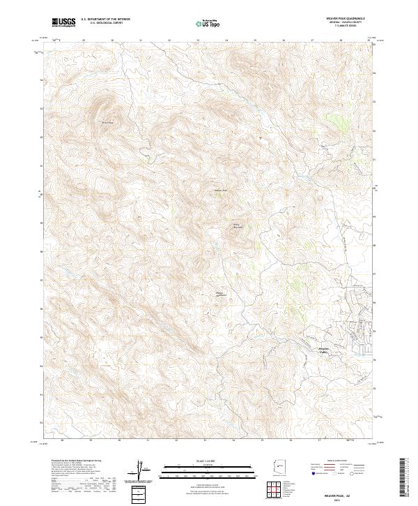
1969 Weaver Peak
Yavapai County, AZ

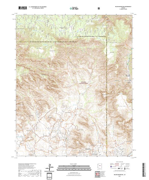
1969 Wilson Mountain
Yavapai County, AZ
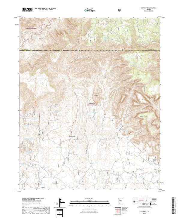
1970 Loy Butte
Yavapai County, AZ
1973 Cathedral Caves
Yavapai County, AZ
1973 Cherry
Yavapai County, AZ
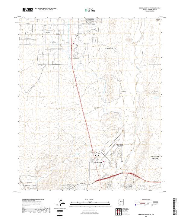
1973 Chino Valley South
Yavapai County, AZ
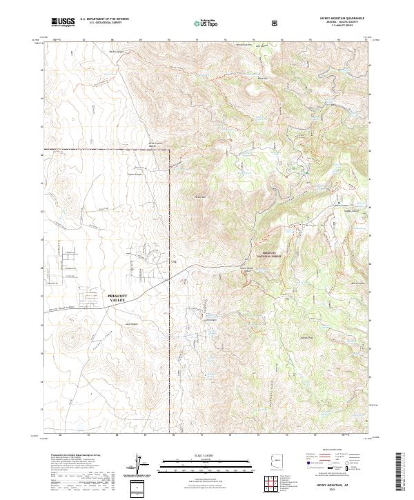
1973 Hickey Mountain
Yavapai County, AZ
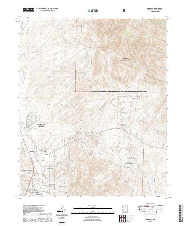
1973 Humboldt
Yavapai County, AZ
1973 Munds Draw
Yavapai County, AZ
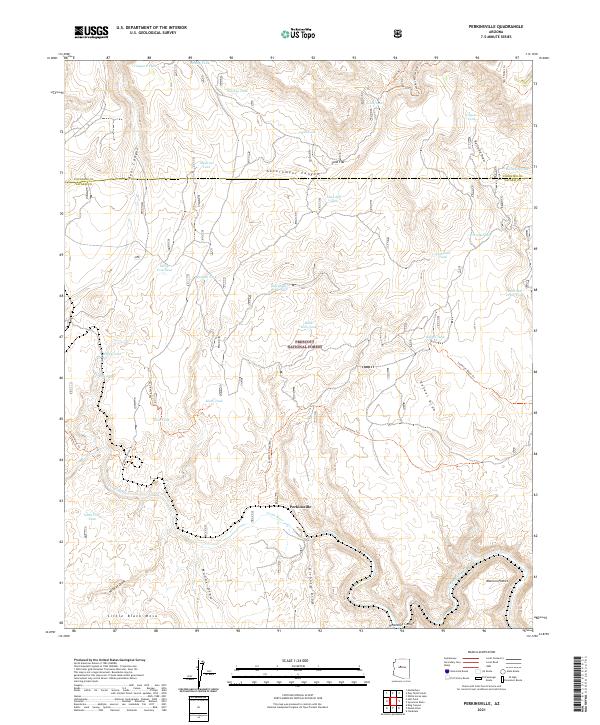
1973 Perkinsville
Yavapai County, AZ
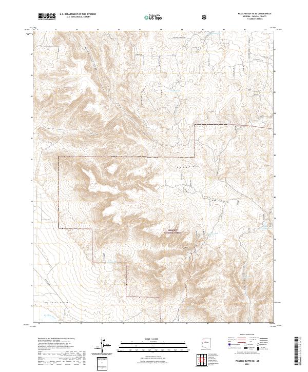
1973 Picacho Butte SE
Yavapai County, AZ
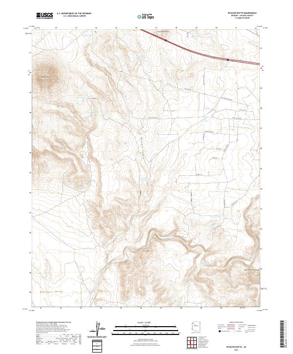
1973 Picacho Butte
Yavapai County, AZ
1973 Prescott Valley North
Yavapai County, AZ
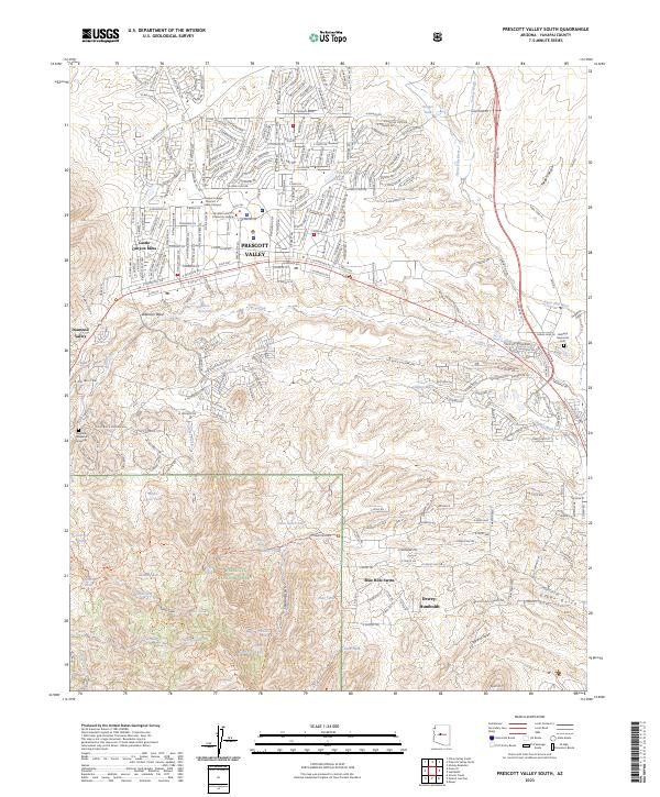
1973 Prescott Valley South
Yavapai County, AZ
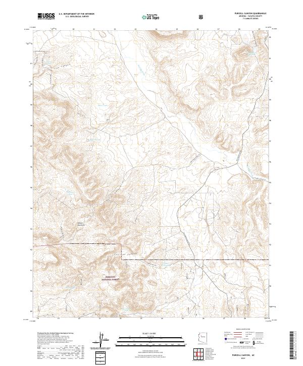
1973 Purcell Canyon
Yavapai County, AZ
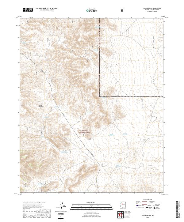
1973 Red Mountain
Yavapai County, AZ
1973 South Butte
Yavapai County, AZ
1973 Sycamore Basin
Yavapai County, AZ
1973 Turkey Canyon NE
Yavapai County, AZ
1973 Turkey Canyon
Yavapai County, AZ
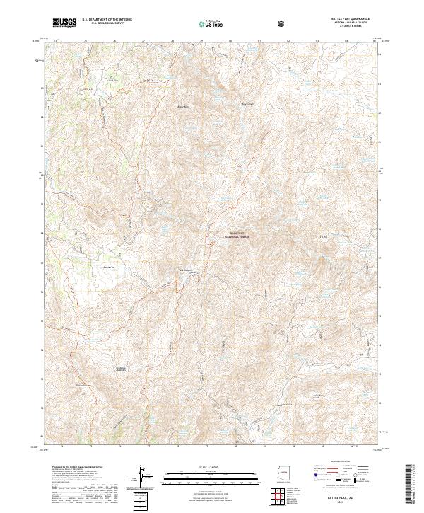
1974 Battle Flat
Yavapai County, AZ
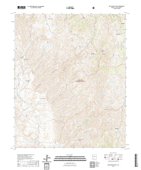
1974 Battleship Butte
Yavapai County, AZ
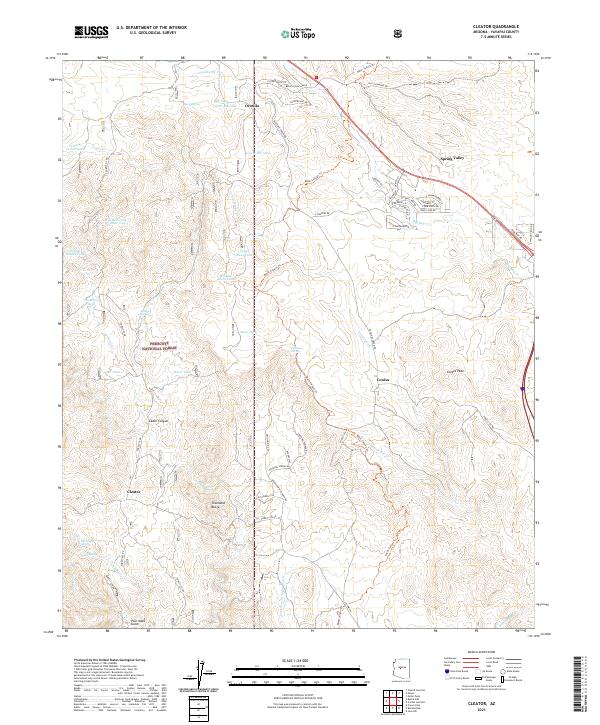
1974 Cleator
Yavapai County, AZ
1974 Cordes Junction
Yavapai County, AZ
1974 Estler Peak
Yavapai County, AZ
1974 Groom Creek
Yavapai County, AZ
1975 Poland Junction
Yavapai County, AZ
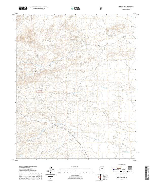
1978 Limestone Peak
Yavapai County, AZ
1979 Chino Valley North
Yavapai County, AZ
1979 Hell Point
Yavapai County, AZ
1979 Iron Springs
Yavapai County, AZ
1979 Jerome Canyon
Yavapai County, AZ
1979 King Canyon
Yavapai County, AZ
1979 Limestone Peak
Yavapai County, AZ
1979 Meath Spring
Yavapai County, AZ
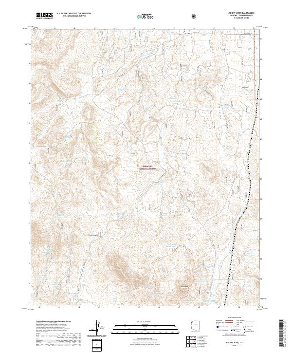
1979 Mount Josh
Yavapai County, AZ
1979 Simmons
Yavapai County, AZ
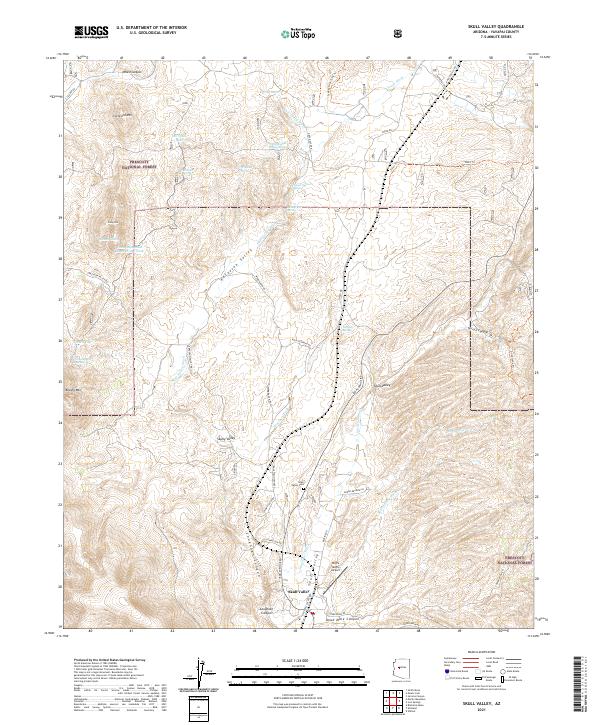
1979 Skull Valley
Yavapai County, AZ
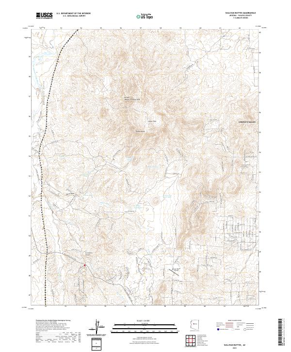
1979 Sullivan Buttes
Yavapai County, AZ
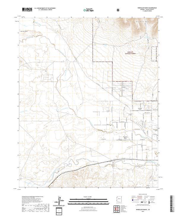
1979 Wineglass Ranch
Yavapai County, AZ
1980 Anvil Rock Ranch
Yavapai County, AZ

1980 Anvil Rock
Yavapai County, AZ
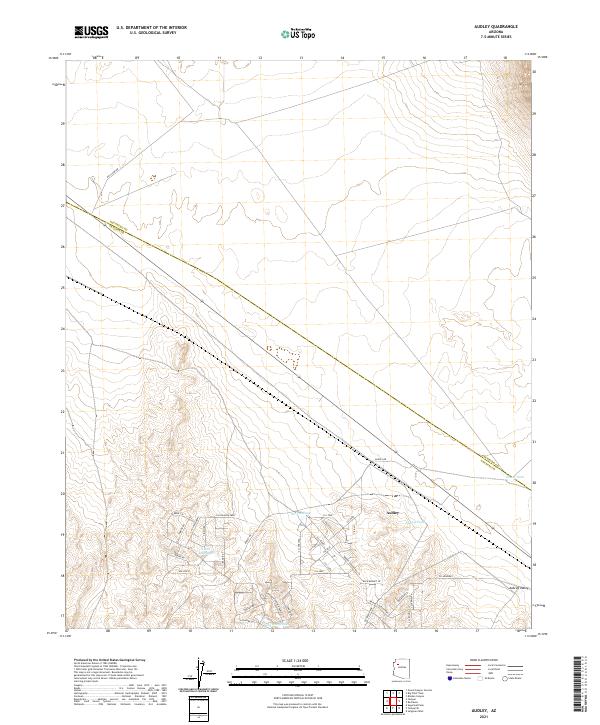
1980 Audley
Yavapai County, AZ
1980 Blye Canyon NE
Yavapai County, AZ
1980 Blye Canyon SE
Yavapai County, AZ
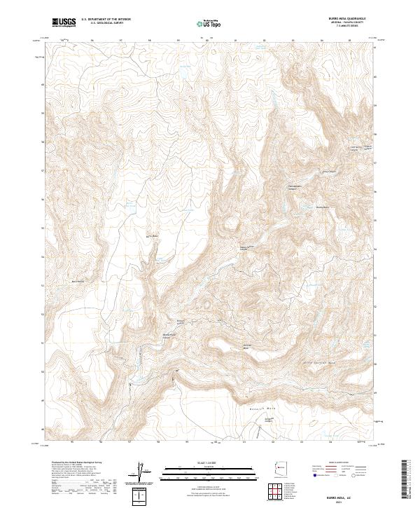
1980 Burro Mesa
Yavapai County, AZ
1980 Cross Mountain
Yavapai County, AZ
1980 Devils Hump
Yavapai County, AZ
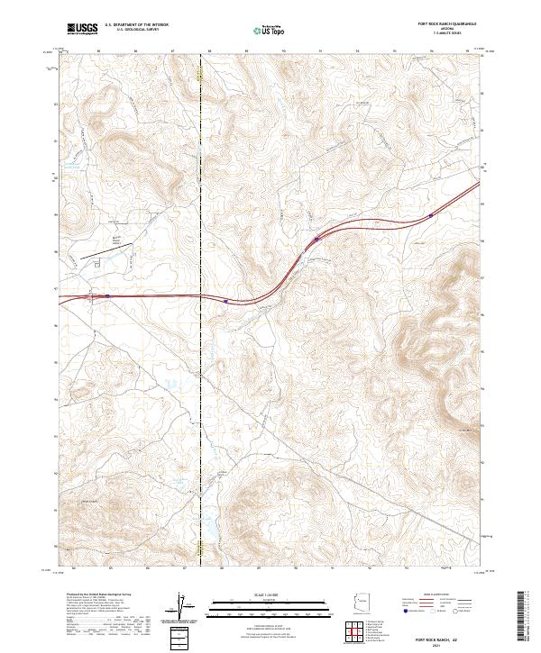
1980 Fort Rock Ranch
Yavapai County, AZ
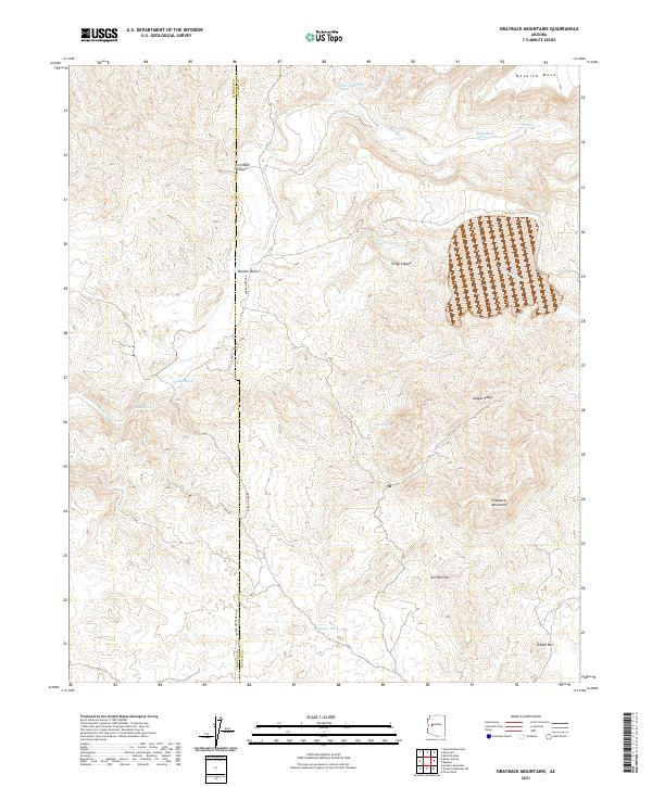
1980 Grayback Mts.
Yavapai County, AZ
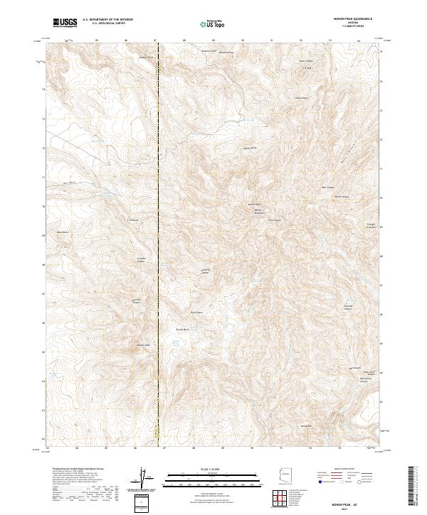
1980 Mohon Peak
Yavapai County, AZ
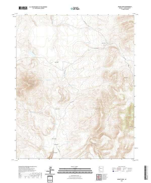
1980 Mount Hope
Yavapai County, AZ
1980 Negro Ed
Yavapai County, AZ
1980 Pilot Knob
Yavapai County, AZ
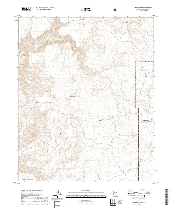
1980 Scratch Canyon
Yavapai County, AZ
1980 Squaw Peak
Yavapai County, AZ
1980 Sunrise Peak
Yavapai County, AZ
1981 Bradshaw Mts
Yavapai County, AZ
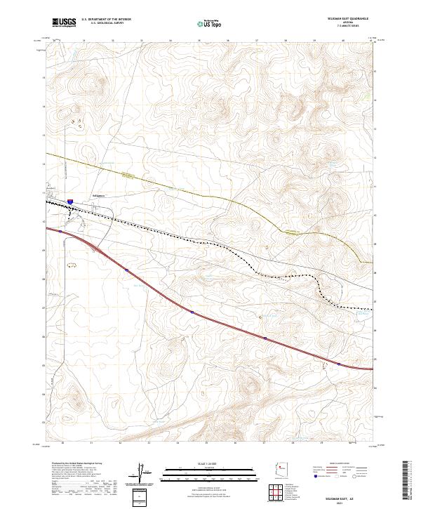
1981 Seligman East
Yavapai County, AZ
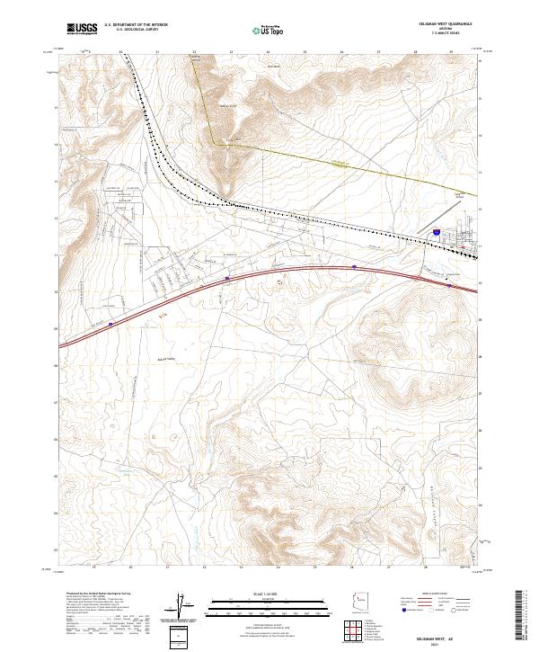
1981 Seligman West
Yavapai County, AZ
1981 Sugarloaf Peak
Yavapai County, AZ
1981 Yampai SE
Yavapai County, AZ
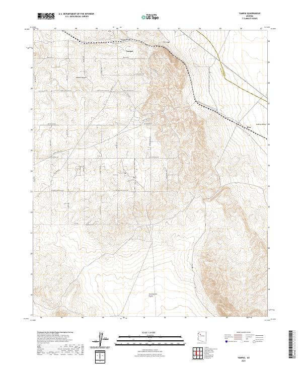
1981 Yampai
Yavapai County, AZ
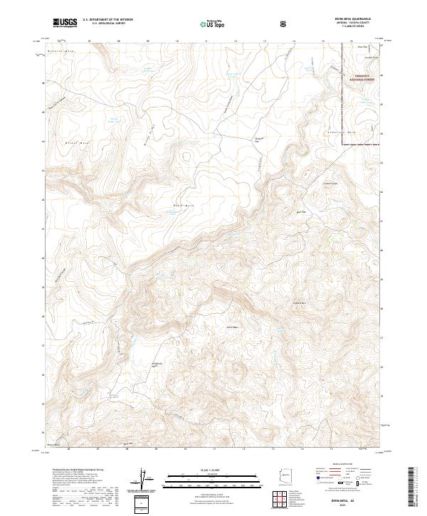
1986 Behm Mesa
Yavapai County, AZ
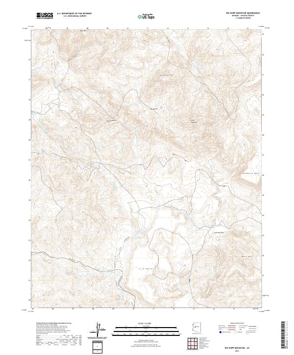
1986 Big Shipp Mountain
Yavapai County, AZ
1986 Bozarth Mesa
Yavapai County, AZ
1986 Camp Wood
Yavapai County, AZ
1986 Indian Peak
Yavapai County, AZ
1986 Juniper Mountains
Yavapai County, AZ
1986 Martin Mountain
Yavapai County, AZ
1986 Muleshoe Ranch
Yavapai County, AZ
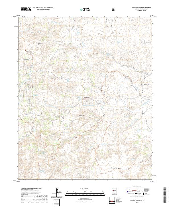
1986 Seepage Mountain
Yavapai County, AZ
1986 Sheridan Mountain
Yavapai County, AZ
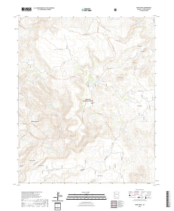
1986 Smith Mesa
Yavapai County, AZ
2004 Bloody Basin
Yavapai County, AZ
2004 Brooklyn Peak
Yavapai County, AZ
2004 Chalk Mountain
Yavapai County, AZ
2004 Cooks Mesa
Yavapai County, AZ
2004 Hackberry Mountain
Yavapai County, AZ
2004 Joes Hill
Yavapai County, AZ
2004 Rover Peak
Yavapai County, AZ
2004 Squaw Creek Mesa
Yavapai County, AZ
2004 Table Mountain
Yavapai County, AZ
2004 Verde Hot Springs
Yavapai County, AZ
2004 Wet Bottom Mesa
Yavapai County, AZ
2011 Anvil Rock Ranch
Yavapai County, AZ
2011 Apache Maid Mountain
Yavapai County, AZ
2011 Arrastra Mountain NE
Yavapai County, AZ
2011 Arrastra Mountain SE
Yavapai County, AZ
2011 Audley
Yavapai County, AZ
2011 Big Shipp Mountain
Yavapai County, AZ
2011 Bismarck Mesa
Yavapai County, AZ
2011 Blye Canyon NE
Yavapai County, AZ
2011 Blye Canyon SE
Yavapai County, AZ
2011 Bozarth Mesa
Yavapai County, AZ
2011 Brooklyn Peak
Yavapai County, AZ
2011 Buckhorn Mountain
Yavapai County, AZ
2011 Burro Mesa
Yavapai County, AZ
2011 Casner Butte
Yavapai County, AZ
2011 Cathedral Caves
Yavapai County, AZ
2011 Chalk Mountain
Yavapai County, AZ
2011 Chino Valley South
Yavapai County, AZ
2011 Columbia
Yavapai County, AZ
2011 Congress SW
Yavapai County, AZ
2011 Cooks Mesa
Yavapai County, AZ
2011 Copperopolis
Yavapai County, AZ
2011 Cross Mountain
Yavapai County, AZ
2011 Date Creek Ranch NW
Yavapai County, AZ
2011 Date Creek Ranch SE
Yavapai County, AZ
2011 Date Creek Ranch SW
Yavapai County, AZ
2011 Date Creek Ranch
Yavapai County, AZ
2011 Date
Yavapai County, AZ
2011 Devils Hump
Yavapai County, AZ
2011 Flores
Yavapai County, AZ
2011 Fort Rock Ranch
Yavapai County, AZ
2011 Garfias Mountain
Yavapai County, AZ
2011 Governors Peak
Yavapai County, AZ
2011 Grayback Mountains
Yavapai County, AZ
2011 Hillside
Yavapai County, AZ
2011 Ives Peak
Yavapai County, AZ
2011 Joes Hill
Yavapai County, AZ
2011 Kirkland
Yavapai County, AZ
2011 Malpais Mesa NE
Yavapai County, AZ
2011 Malpais Mesa
Yavapai County, AZ
2011 Mohon Peak
Yavapai County, AZ
2011 Morgan Butte
Yavapai County, AZ
2011 Mount Hope
Yavapai County, AZ
2011 Negro Ed
Yavapai County, AZ
2011 O'Neill Pass
Yavapai County, AZ
2011 Page Springs
Yavapai County, AZ
2011 Picacho Butte
Yavapai County, AZ
2011 Pilot Knob
Yavapai County, AZ
2011 Rover Peak
Yavapai County, AZ
2011 Sam Powell Peak
Yavapai County, AZ
2011 Seligman East
Yavapai County, AZ
2011 Seligman West
Yavapai County, AZ
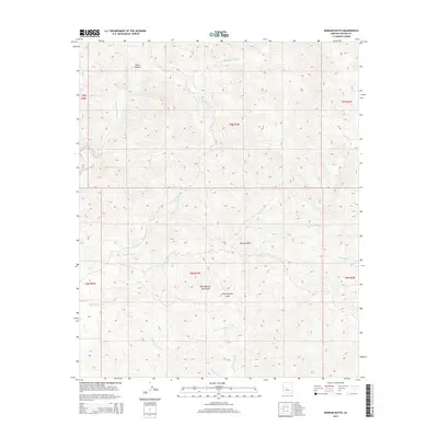
2011 Smith Peak NE
Yavapai County, AZ
2011 Smith Peak
Yavapai County, AZ
2011 Sugarloaf Peak
Yavapai County, AZ
2011 Sullivan Buttes
Yavapai County, AZ
2011 Sunrise Peak
Yavapai County, AZ
2011 Table Mountain
Yavapai County, AZ
2011 Thorn Peak
Yavapai County, AZ
2011 Walker Mountain
Yavapai County, AZ
2011 Weaver Peak
Yavapai County, AZ
2011 Wet Bottom Mesa
Yavapai County, AZ
2011 Willow Spring Canyon
Yavapai County, AZ
2011 Wilson Mountain
Yavapai County, AZ
2011 Yampai SE
Yavapai County, AZ
2011 Yampai
Yavapai County, AZ
2012 Anvil Rock
Yavapai County, AZ
2012 Arnold Mesa
Yavapai County, AZ
2012 Battle Flat
Yavapai County, AZ
2012 Battleship Butte
Yavapai County, AZ
2012 Behm Mesa
Yavapai County, AZ
2012 Bloody Basin
Yavapai County, AZ
2012 Bumble Bee
Yavapai County, AZ
2012 Camp Wood
Yavapai County, AZ
2012 Cherry
Yavapai County, AZ
2012 Chino Valley North
Yavapai County, AZ
2012 Cleator
Yavapai County, AZ
2012 Cordes Junction
Yavapai County, AZ
2012 Crown King
Yavapai County, AZ
2012 Dugas
Yavapai County, AZ
2012 Estler Peak
Yavapai County, AZ
2012 Groom Creek
Yavapai County, AZ
2012 Hackberry Mountain
Yavapai County, AZ
2012 Hell Point
Yavapai County, AZ
2012 Hickey Mountain
Yavapai County, AZ
2012 Horner Mountain
Yavapai County, AZ
2012 Humboldt
Yavapai County, AZ
2012 Indian Peak
Yavapai County, AZ
2012 Iron Springs
Yavapai County, AZ
2012 Jerome Canyon
Yavapai County, AZ
2012 Juniper Mountains
Yavapai County, AZ
2012 King Canyon
Yavapai County, AZ
2012 Limestone Peak
Yavapai County, AZ
2012 Loy Butte
Yavapai County, AZ
2012 Martin Mountain
Yavapai County, AZ
2012 Meath Spring
Yavapai County, AZ
2012 Middle Verde
Yavapai County, AZ
2012 Minnehaha
Yavapai County, AZ
2012 Mount Josh
Yavapai County, AZ
2012 Muleshoe Ranch
Yavapai County, AZ
2012 Munds Draw
Yavapai County, AZ
2012 Perkinsville
Yavapai County, AZ
2012 Picacho Butte SE
Yavapai County, AZ
2012 Poland Junction
Yavapai County, AZ
2012 Prescott Valley North
Yavapai County, AZ
2012 Prescott Valley South
Yavapai County, AZ
2012 Purcell Canyon
Yavapai County, AZ
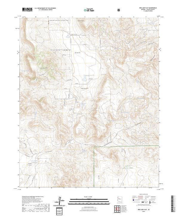
2012 Red Lake Flat
Yavapai County, AZ
2012 Red Mountain
Yavapai County, AZ
2012 Scratch Canyon
Yavapai County, AZ
2012 Seepage Mountain
Yavapai County, AZ
2012 Sheridan Mountain
Yavapai County, AZ
2012 Simmons
Yavapai County, AZ
2012 Skull Valley
Yavapai County, AZ
2012 Smith Mesa
Yavapai County, AZ
2012 South Butte
Yavapai County, AZ
2012 Sycamore Basin
Yavapai County, AZ
2012 Tule Mesa
Yavapai County, AZ
2012 Turkey Canyon NE
Yavapai County, AZ
2012 Turkey Canyon
Yavapai County, AZ
2012 Verde Hot Springs
Yavapai County, AZ
2012 Wagoner
Yavapai County, AZ
2012 Walnut Grove
Yavapai County, AZ
2012 Wineglass Ranch
Yavapai County, AZ
2014 Anvil Rock Ranch
Yavapai County, AZ
2014 Anvil Rock
Yavapai County, AZ
2014 Apache Maid Mountain
Yavapai County, AZ
2014 Arnold Mesa
Yavapai County, AZ
2014 Arrastra Mountain NE
Yavapai County, AZ
2014 Arrastra Mountain SE
Yavapai County, AZ
2014 Audley
Yavapai County, AZ
2014 Battle Flat
Yavapai County, AZ
2014 Battleship Butte
Yavapai County, AZ
2014 Behm Mesa
Yavapai County, AZ
2014 Big Shipp Mountain
Yavapai County, AZ
2014 Bismarck Mesa
Yavapai County, AZ
2014 Bloody Basin
Yavapai County, AZ
2014 Blye Canyon NE
Yavapai County, AZ
2014 Blye Canyon SE
Yavapai County, AZ
2014 Bozarth Mesa
Yavapai County, AZ
2014 Brooklyn Peak
Yavapai County, AZ
2014 Buckhorn Mountain
Yavapai County, AZ
2014 Bumble Bee
Yavapai County, AZ
2014 Burro Mesa
Yavapai County, AZ
2014 Camp Wood
Yavapai County, AZ
2014 Casner Butte
Yavapai County, AZ
2014 Cathedral Caves
Yavapai County, AZ
2014 Chalk Mountain
Yavapai County, AZ
2014 Cherry
Yavapai County, AZ
2014 Chino Valley North
Yavapai County, AZ
2014 Chino Valley South
Yavapai County, AZ
2014 Cleator
Yavapai County, AZ
2014 Columbia
Yavapai County, AZ
2014 Congress SW
Yavapai County, AZ
2014 Cooks Mesa
Yavapai County, AZ
2014 Copperopolis
Yavapai County, AZ
2014 Cordes Junction
Yavapai County, AZ
2014 Cross Mountain
Yavapai County, AZ
2014 Crown King
Yavapai County, AZ

2014 Date Creek Ranch NW
Yavapai County, AZ
2014 Date Creek Ranch SE
Yavapai County, AZ
2014 Date Creek Ranch SW
Yavapai County, AZ
2014 Date Creek Ranch
Yavapai County, AZ
2014 Date
Yavapai County, AZ
2014 Devils Hump
Yavapai County, AZ
2014 Dugas
Yavapai County, AZ
2014 Estler Peak
Yavapai County, AZ
2014 Flores
Yavapai County, AZ
2014 Fort Rock Ranch
Yavapai County, AZ
2014 Garfias Mountain
Yavapai County, AZ
2014 Governors Peak
Yavapai County, AZ
2014 Grayback Mountains
Yavapai County, AZ
2014 Groom Creek
Yavapai County, AZ
2014 Hackberry Mountain
Yavapai County, AZ
2014 Hell Point
Yavapai County, AZ
2014 Hickey Mountain
Yavapai County, AZ
2014 Hillside
Yavapai County, AZ
2014 Horner Mountain
Yavapai County, AZ
2014 Humboldt
Yavapai County, AZ
2014 Indian Peak
Yavapai County, AZ
2014 Iron Springs
Yavapai County, AZ
2014 Ives Peak
Yavapai County, AZ
2014 Jerome Canyon
Yavapai County, AZ
2014 Joes Hill
Yavapai County, AZ
2014 Juniper Mountains
Yavapai County, AZ
2014 King Canyon
Yavapai County, AZ
2014 Kirkland
Yavapai County, AZ
2014 Limestone Peak
Yavapai County, AZ
2014 Loy Butte
Yavapai County, AZ
2014 Malpais Mesa NE
Yavapai County, AZ
2014 Malpais Mesa
Yavapai County, AZ
2014 Martin Mountain
Yavapai County, AZ
2014 Meath Spring
Yavapai County, AZ
2014 Middle Verde
Yavapai County, AZ
2014 Minnehaha
Yavapai County, AZ
2014 Mohon Peak
Yavapai County, AZ
2014 Morgan Butte
Yavapai County, AZ
2014 Mount Hope
Yavapai County, AZ
2014 Mount Josh
Yavapai County, AZ
2014 Muleshoe Ranch
Yavapai County, AZ
2014 Munds Draw
Yavapai County, AZ
2014 Negro Ed
Yavapai County, AZ
2014 O'Neill Pass
Yavapai County, AZ
2014 Page Springs
Yavapai County, AZ
2014 Perkinsville
Yavapai County, AZ
2014 Picacho Butte SE
Yavapai County, AZ
2014 Picacho Butte
Yavapai County, AZ
2014 Pilot Knob
Yavapai County, AZ
2014 Poland Junction
Yavapai County, AZ
2014 Prescott Valley North
Yavapai County, AZ
2014 Prescott Valley South
Yavapai County, AZ
2014 Purcell Canyon
Yavapai County, AZ
2014 Red Lake Flat
Yavapai County, AZ
2014 Red Mountain
Yavapai County, AZ
2014 Rover Peak
Yavapai County, AZ
2014 Sam Powell Peak
Yavapai County, AZ
2014 Scratch Canyon
Yavapai County, AZ
2014 Seepage Mountain
Yavapai County, AZ
2014 Seligman East
Yavapai County, AZ
2014 Seligman West
Yavapai County, AZ
2014 Sheridan Mountain
Yavapai County, AZ
2014 Simmons
Yavapai County, AZ
2014 Skull Valley
Yavapai County, AZ
2014 Smith Mesa
Yavapai County, AZ
2014 Smith Peak NE
Yavapai County, AZ
2014 Smith Peak
Yavapai County, AZ
2014 South Butte
Yavapai County, AZ
2014 Sugarloaf Peak
Yavapai County, AZ
2014 Sullivan Buttes
Yavapai County, AZ
2014 Sunrise Peak
Yavapai County, AZ
2014 Sycamore Basin
Yavapai County, AZ
2014 Table Mountain
Yavapai County, AZ
2014 Thorn Peak
Yavapai County, AZ
2014 Tule Mesa
Yavapai County, AZ
2014 Turkey Canyon NE
Yavapai County, AZ
2014 Turkey Canyon
Yavapai County, AZ
2014 Verde Hot Springs
Yavapai County, AZ
2014 Wagoner
Yavapai County, AZ
2014 Walker Mountain
Yavapai County, AZ
2014 Walnut Grove
Yavapai County, AZ
2014 Weaver Peak
Yavapai County, AZ
2014 Wet Bottom Mesa
Yavapai County, AZ
2014 Willow Spring Canyon
Yavapai County, AZ
2014 Wilson Mountain
Yavapai County, AZ
2014 Wineglass Ranch
Yavapai County, AZ
2014 Yampai SE
Yavapai County, AZ
2014 Yampai
Yavapai County, AZ
2018 Anvil Rock Ranch
Yavapai County, AZ
2018 Anvil Rock
Yavapai County, AZ
2018 Apache Maid Mountain
Yavapai County, AZ
2018 Arnold Mesa
Yavapai County, AZ
2018 Arrastra Mountain NE
Yavapai County, AZ
2018 Arrastra Mountain SE
Yavapai County, AZ
2018 Audley
Yavapai County, AZ
2018 Battle Flat
Yavapai County, AZ
2018 Battleship Butte
Yavapai County, AZ
2018 Behm Mesa
Yavapai County, AZ
2018 Big Shipp Mountain
Yavapai County, AZ
2018 Bismarck Mesa
Yavapai County, AZ
2018 Bloody Basin
Yavapai County, AZ
2018 Blye Canyon NE
Yavapai County, AZ
2018 Blye Canyon SE
Yavapai County, AZ
2018 Bozarth Mesa
Yavapai County, AZ
2018 Brooklyn Peak
Yavapai County, AZ
2018 Buckhorn Mountain
Yavapai County, AZ
2018 Bumble Bee
Yavapai County, AZ
2018 Burro Mesa
Yavapai County, AZ
2018 Camp Wood
Yavapai County, AZ
2018 Casner Butte
Yavapai County, AZ
2018 Cathedral Caves
Yavapai County, AZ
2018 Chalk Mountain
Yavapai County, AZ
2018 Cherry
Yavapai County, AZ
2018 Chino Valley North
Yavapai County, AZ
2018 Chino Valley South
Yavapai County, AZ
2018 Cleator
Yavapai County, AZ
2018 Columbia
Yavapai County, AZ
2018 Congress SW
Yavapai County, AZ
2018 Cooks Mesa
Yavapai County, AZ
2018 Copperopolis
Yavapai County, AZ
2018 Cordes Junction
Yavapai County, AZ
2018 Cross Mountain
Yavapai County, AZ
2018 Crown King
Yavapai County, AZ
2018 Date Creek Ranch NW
Yavapai County, AZ
2018 Date Creek Ranch SE
Yavapai County, AZ
2018 Date Creek Ranch SW
Yavapai County, AZ
2018 Date Creek Ranch
Yavapai County, AZ
2018 Date
Yavapai County, AZ
2018 Devils Hump
Yavapai County, AZ
2018 Dugas
Yavapai County, AZ
2018 Estler Peak
Yavapai County, AZ
2018 Flores
Yavapai County, AZ
2018 Fort Rock Ranch
Yavapai County, AZ
2018 Garfias Mountain
Yavapai County, AZ
2018 Governors Peak
Yavapai County, AZ
2018 Grayback Mountains
Yavapai County, AZ
2018 Groom Creek
Yavapai County, AZ
2018 Hackberry Mountain
Yavapai County, AZ
2018 Hell Point
Yavapai County, AZ
2018 Hickey Mountain
Yavapai County, AZ
2018 Hillside
Yavapai County, AZ
2018 Horner Mountain
Yavapai County, AZ
2018 Humboldt
Yavapai County, AZ
2018 Indian Peak
Yavapai County, AZ
2018 Iron Springs
Yavapai County, AZ
2018 Ives Peak
Yavapai County, AZ
2018 Jerome Canyon
Yavapai County, AZ
2018 Joes Hill
Yavapai County, AZ
2018 Juniper Mountains
Yavapai County, AZ
2018 King Canyon
Yavapai County, AZ
2018 Kirkland
Yavapai County, AZ
2018 Limestone Peak
Yavapai County, AZ
2018 Loy Butte
Yavapai County, AZ
2018 Malpais Mesa NE
Yavapai County, AZ
2018 Malpais Mesa
Yavapai County, AZ
2018 Martin Mountain
Yavapai County, AZ
2018 Meath Spring
Yavapai County, AZ
2018 Middle Verde
Yavapai County, AZ
2018 Minnehaha
Yavapai County, AZ
2018 Mohon Peak
Yavapai County, AZ
2018 Morgan Butte
Yavapai County, AZ
2018 Mount Hope
Yavapai County, AZ
2018 Mount Josh
Yavapai County, AZ
2018 Muleshoe Ranch
Yavapai County, AZ
2018 Munds Draw
Yavapai County, AZ
2018 Negro Ed
Yavapai County, AZ
2018 O'Neill Pass
Yavapai County, AZ
2018 Page Springs
Yavapai County, AZ
2018 Perkinsville
Yavapai County, AZ
2018 Picacho Butte SE
Yavapai County, AZ
2018 Picacho Butte
Yavapai County, AZ
2018 Pilot Knob
Yavapai County, AZ
2018 Poland Junction
Yavapai County, AZ
2018 Prescott Valley North
Yavapai County, AZ
2018 Prescott Valley South
Yavapai County, AZ
2018 Purcell Canyon
Yavapai County, AZ
2018 Red Lake Flat
Yavapai County, AZ
2018 Red Mountain
Yavapai County, AZ
2018 Rover Peak
Yavapai County, AZ
2018 Sam Powell Peak
Yavapai County, AZ
2018 Scratch Canyon
Yavapai County, AZ
2018 Seepage Mountain
Yavapai County, AZ
2018 Seligman East
Yavapai County, AZ
2018 Seligman West
Yavapai County, AZ
2018 Sheridan Mountain
Yavapai County, AZ
2018 Simmons
Yavapai County, AZ
2018 Skull Valley
Yavapai County, AZ
2018 Smith Mesa
Yavapai County, AZ
2018 Smith Peak NE
Yavapai County, AZ
2018 Smith Peak
Yavapai County, AZ
2018 South Butte
Yavapai County, AZ
2018 Sugarloaf Peak
Yavapai County, AZ
2018 Sullivan Buttes
Yavapai County, AZ
2018 Sunrise Peak
Yavapai County, AZ
2018 Sycamore Basin
Yavapai County, AZ
2018 Table Mountain
Yavapai County, AZ
2018 Thorn Peak
Yavapai County, AZ
2018 Tule Mesa
Yavapai County, AZ
2018 Turkey Canyon NE
Yavapai County, AZ
2018 Turkey Canyon
Yavapai County, AZ
2018 Verde Hot Springs
Yavapai County, AZ
2018 Wagoner
Yavapai County, AZ
2018 Walker Mountain
Yavapai County, AZ
2018 Walnut Grove
Yavapai County, AZ
2018 Weaver Peak
Yavapai County, AZ
2018 Wet Bottom Mesa
Yavapai County, AZ
2018 Willow Spring Canyon
Yavapai County, AZ
2018 Wilson Mountain
Yavapai County, AZ
2018 Wineglass Ranch
Yavapai County, AZ
2018 Yampai SE
Yavapai County, AZ
2018 Yampai
Yavapai County, AZ
2021 Anvil Rock Ranch
Yavapai County, AZ
2021 Anvil Rock
Yavapai County, AZ
2021 Apache Maid Mountain
Yavapai County, AZ
2021 Arnold Mesa
Yavapai County, AZ
2021 Arrastra Mountain NE
Yavapai County, AZ
2021 Arrastra Mountain SE
Yavapai County, AZ
2021 Audley
Yavapai County, AZ
2021 Battle Flat
Yavapai County, AZ
2021 Battleship Butte
Yavapai County, AZ
2021 Behm Mesa
Yavapai County, AZ
2021 Big Shipp Mountain
Yavapai County, AZ
2021 Bismarck Mesa
Yavapai County, AZ
2021 Bloody Basin
Yavapai County, AZ
2021 Blye Canyon NE
Yavapai County, AZ
2021 Blye Canyon SE
Yavapai County, AZ
2021 Bozarth Mesa
Yavapai County, AZ
2021 Brooklyn Peak
Yavapai County, AZ
2021 Buckhorn Mountain
Yavapai County, AZ
2021 Bumble Bee
Yavapai County, AZ
2021 Burro Mesa
Yavapai County, AZ
2021 Camp Wood
Yavapai County, AZ

2021 Casner Butte
Yavapai County, AZ
2021 Cathedral Caves
Yavapai County, AZ
2021 Chalk Mountain
Yavapai County, AZ
2021 Cherry
Yavapai County, AZ
2021 Chino Valley North
Yavapai County, AZ
2021 Chino Valley South
Yavapai County, AZ
2021 Cleator
Yavapai County, AZ
2021 Columbia
Yavapai County, AZ
2021 Congress SW
Yavapai County, AZ
2021 Cooks Mesa
Yavapai County, AZ
2021 Copperopolis
Yavapai County, AZ
2021 Cordes Junction
Yavapai County, AZ
2021 Cross Mountain
Yavapai County, AZ
2021 Crown King
Yavapai County, AZ

2021 Date Creek Ranch NW
Yavapai County, AZ
2021 Date Creek Ranch SE
Yavapai County, AZ
2021 Date Creek Ranch SW
Yavapai County, AZ
2021 Date Creek Ranch
Yavapai County, AZ
2021 Date
Yavapai County, AZ
2021 Devils Hump
Yavapai County, AZ
2021 Dugas
Yavapai County, AZ
2021 Estler Peak
Yavapai County, AZ
2021 Flores
Yavapai County, AZ
2021 Fort Rock Ranch
Yavapai County, AZ
2021 Garfias Mountain
Yavapai County, AZ
2021 Governors Peak
Yavapai County, AZ
2021 Grayback Mountains
Yavapai County, AZ
2021 Groom Creek
Yavapai County, AZ
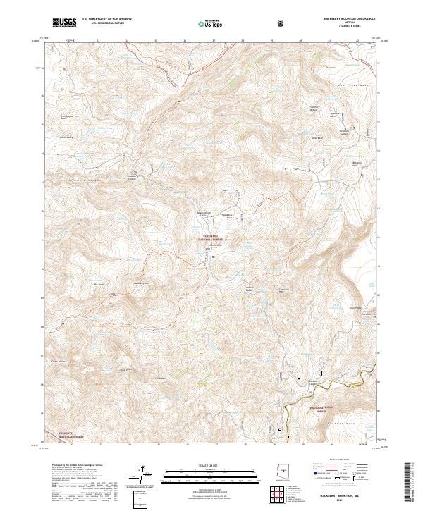
2021 Hackberry Mountain
Yavapai County, AZ
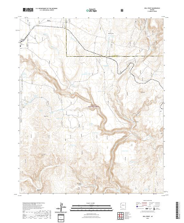
2021 Hell Point
Yavapai County, AZ
2021 Hickey Mountain
Yavapai County, AZ
2021 Hillside
Yavapai County, AZ
2021 Horner Mountain
Yavapai County, AZ
2021 Humboldt
Yavapai County, AZ
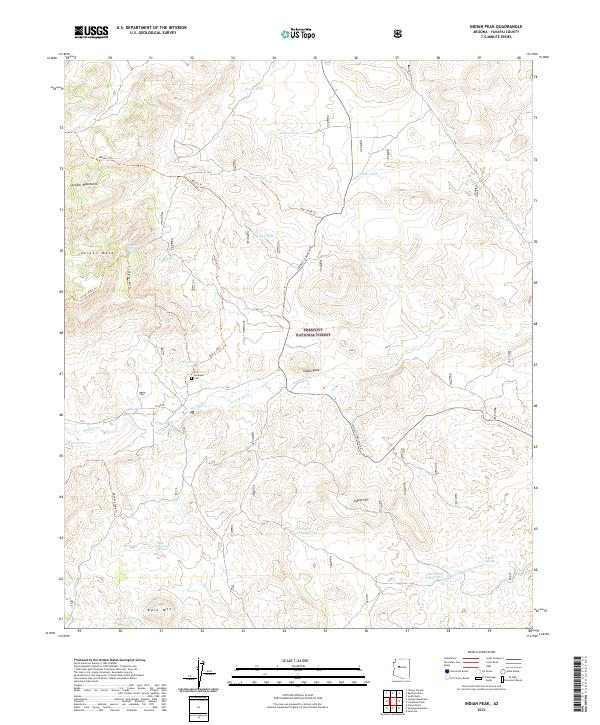
2021 Indian Peak
Yavapai County, AZ
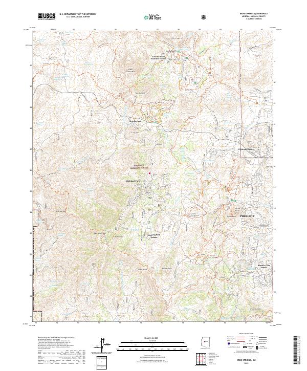
2021 Iron Springs
Yavapai County, AZ
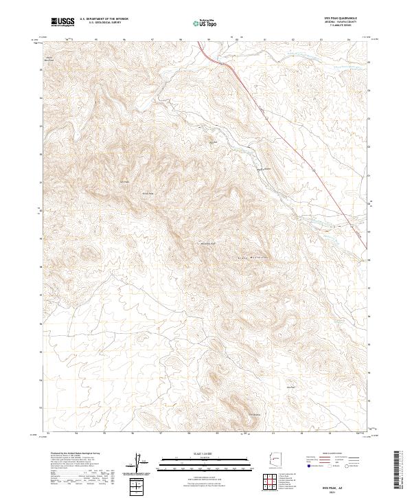
2021 Ives Peak
Yavapai County, AZ
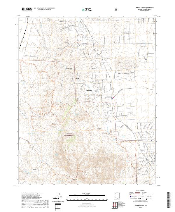
2021 Jerome Canyon
Yavapai County, AZ
2021 Joes Hill
Yavapai County, AZ
2021 Juniper Mountains
Yavapai County, AZ
2021 King Canyon
Yavapai County, AZ
2021 Kirkland
Yavapai County, AZ
2021 Limestone Peak
Yavapai County, AZ
2021 Loy Butte
Yavapai County, AZ
2021 Malpais Mesa NE
Yavapai County, AZ
2021 Malpais Mesa
Yavapai County, AZ
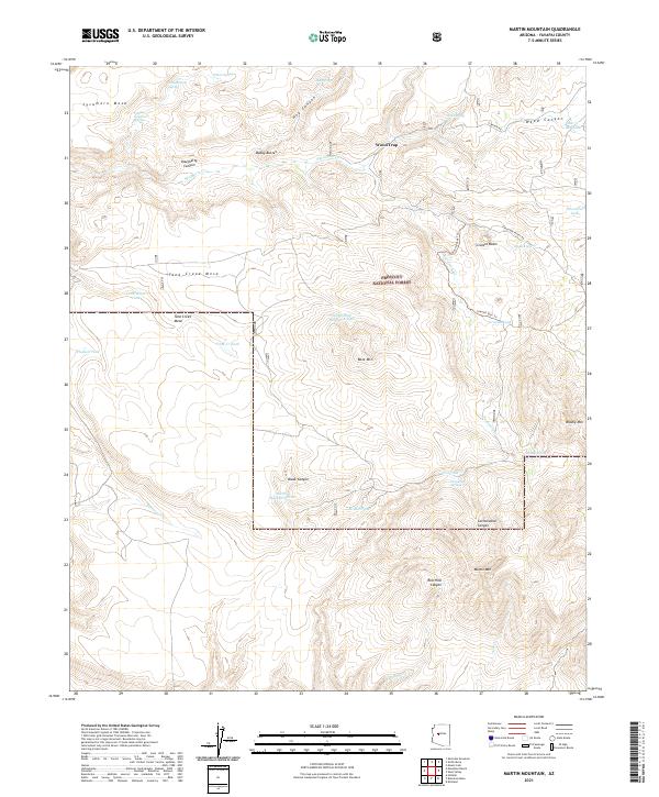
2021 Martin Mountain
Yavapai County, AZ
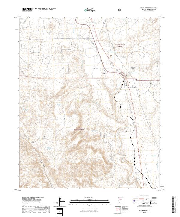
2021 Meath Spring
Yavapai County, AZ
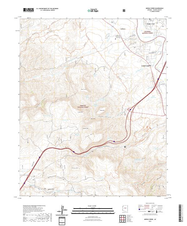
2021 Middle Verde
Yavapai County, AZ
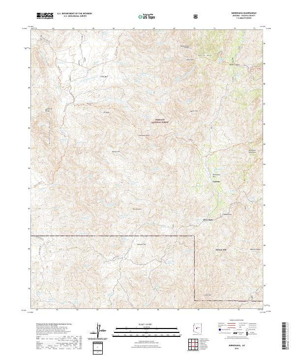
2021 Minnehaha
Yavapai County, AZ
2021 Mohon Peak
Yavapai County, AZ
2021 Morgan Butte
Yavapai County, AZ
2021 Mount Hope
Yavapai County, AZ
2021 Mount Josh
Yavapai County, AZ
2021 Muleshoe Ranch
Yavapai County, AZ
2021 Munds Draw
Yavapai County, AZ
2021 Negro Ed
Yavapai County, AZ
2021 O'Neill Pass
Yavapai County, AZ
2021 Page Springs
Yavapai County, AZ
2021 Perkinsville
Yavapai County, AZ
2021 Picacho Butte SE
Yavapai County, AZ
2021 Picacho Butte
Yavapai County, AZ
2021 Pilot Knob
Yavapai County, AZ
2021 Poland Junction
Yavapai County, AZ
2021 Prescott Valley North
Yavapai County, AZ
2021 Prescott Valley South
Yavapai County, AZ
2021 Purcell Canyon
Yavapai County, AZ
2021 Red Lake Flat
Yavapai County, AZ
2021 Red Mountain
Yavapai County, AZ

2021 Rover Peak
Yavapai County, AZ
2021 Sam Powell Peak
Yavapai County, AZ
2021 Scratch Canyon
Yavapai County, AZ
2021 Seepage Mountain
Yavapai County, AZ
2021 Seligman East
Yavapai County, AZ
2021 Seligman West
Yavapai County, AZ
2021 Sheridan Mountain
Yavapai County, AZ
2021 Simmons
Yavapai County, AZ
2021 Skull Valley
Yavapai County, AZ
2021 Smith Mesa
Yavapai County, AZ
2021 Smith Peak NE
Yavapai County, AZ
2021 Smith Peak
Yavapai County, AZ
2021 South Butte
Yavapai County, AZ
2021 Sugarloaf Peak
Yavapai County, AZ
2021 Sullivan Buttes
Yavapai County, AZ
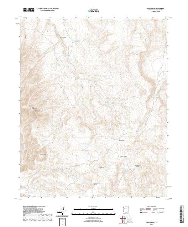
2021 Sunrise Peak
Yavapai County, AZ
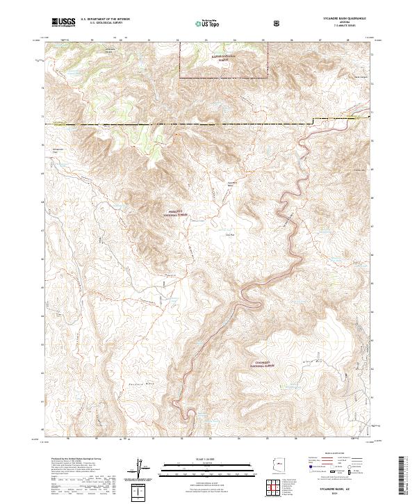
2021 Sycamore Basin
Yavapai County, AZ
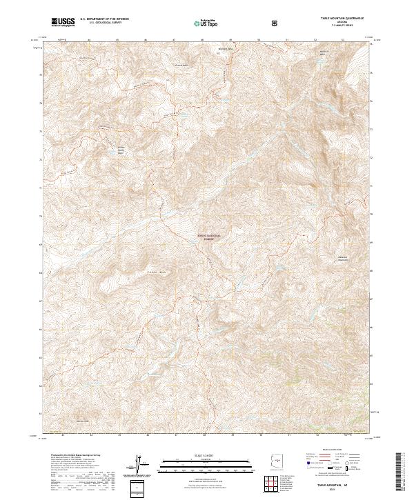
2021 Table Mountain
Yavapai County, AZ

2021 Thorn Peak
Yavapai County, AZ
2021 Tule Mesa
Yavapai County, AZ
2021 Turkey Canyon NE
Yavapai County, AZ
2021 Turkey Canyon
Yavapai County, AZ
2021 Verde Hot Springs
Yavapai County, AZ

2021 Wagoner
Yavapai County, AZ
2021 Walker Mountain
Yavapai County, AZ
2021 Walnut Grove
Yavapai County, AZ
2021 Weaver Peak
Yavapai County, AZ
2021 Wet Bottom Mesa
Yavapai County, AZ
2021 Willow Spring Canyon
Yavapai County, AZ
2021 Wilson Mountain
Yavapai County, AZ
2021 Wineglass Ranch
Yavapai County, AZ
2021 Yampai SE
Yavapai County, AZ
2021 Yampai
Yavapai County, AZ
2023 Arnold Mesa
Yavapai County, AZ
2023 Bismarck Mesa
Yavapai County, AZ
2023 Brooklyn Peak
Yavapai County, AZ
2023 Cooks Mesa
Yavapai County, AZ
2023 Crown King
Yavapai County, AZ
2023 Governors Peak
Yavapai County, AZ
2023 Horner Mountain
Yavapai County, AZ
2023 Joes Hill
Yavapai County, AZ
2023 Prescott Valley South
Yavapai County, AZ
2023 Red Lake Flat
Yavapai County, AZ
2023 Verde Hot Springs
Yavapai County, AZ
2023 Willow Spring Canyon
Yavapai County, AZ
2026 Anvil Rock Ranch
Yavapai County, AZ
2026 Arrastra Mountain NE
Yavapai County, AZ
2026 Battleship Butte
Yavapai County, AZ
2026 Cathedral Caves
Yavapai County, AZ
2026 Columbia
Yavapai County, AZ
2026 Cross Mountain
Yavapai County, AZ
2026 Crown King
Yavapai County, AZ
2026 Devils Hump
Yavapai County, AZ
2026 Groom Creek
Yavapai County, AZ
2026 Humboldt
Yavapai County, AZ
2026 Martin Mountain
Yavapai County, AZ
2026 Mohon Peak
Yavapai County, AZ
2026 Page Springs
Yavapai County, AZ
2026 Red Lake Flat
Yavapai County, AZ
2026 Rover Peak
Yavapai County, AZ
2026 Sunrise Peak
Yavapai County, AZ
2026 Yampai
Yavapai County, AZ