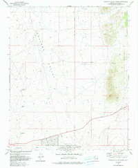
1973 Map of Prescott Valley North
USGS Topo · Published 1991About this map
Lonesome Valley dominates the central landscape of this 1970s survey, illustrating a period of burgeoning infrastructure in central Arizona. The southern portion of the map reveals the early residential grid of Prescott Valley, with streets such as Rockland Dr, Supai Dr, and Laredo Drive established just north of the Agua Fria River. This developing settlement contrasts with the open range and mining history found to the east and north, where the Prescott National Forest boundary marks a shift into higher terrain.
Find a feature on this map
21 named features on this map. Tap any name to fly to it.
Don’t see what you’re looking for? This feature index may not catch every label — zoom into the map to look around manually.
Map Details
Editions of this 1973 Prescott Valley North Map
3 editions found
Other maps of this area

1887 · Prescott
USGS Topo · 1:250,000

1892 · Prescott
USGS Topo · 1:250,000

1905 · Jerome
USGS Topo · 1:125,000

1944 · Clarkdale
USGS Topo · 1:48,000

1944 · Mingus Mountain
USGS Topo · 1:62,500

1947 · Mingus Mtn
USGS Topo · 1:62,500

1947 · Paulden
USGS Topo · 1:62,500

1947 · Prescott
USGS Topo · 1:62,500

1948 · Prescott
USGS Topo · 1:62,500
1948 · Clarkdale
USGS Topo · 1:62,500