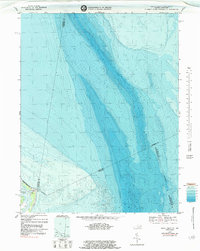
1968 Map of Smith Point
USGS Topo · Published 1984About this map
Bamboo Island and Smith Pt anchor this maritime survey of the mouth of the Potomac River at its confluence with the Chesapeake Bay. This bathymetric-topographic study captures the complex underwater landscape and shifting shorelines that define this coastal boundary between Virginia and Maryland. Significant portions of the map are dedicated to the depth contours of the bay, revealing the subaqueous terrain of the Indefinite Bdy that separates Northumberland Co from its neighbors across the water. The presence of a Light at the point underscores the area's importance for coastal navigation. This edition reflects the environment as it appeared in the late 1960s, with bathymetric data integrated to show the relationship between the low-lying coastal land and the surrounding waters.
Find a feature on this map
11 named features on this map. Tap any name to fly to it.
Don’t see what you’re looking for? This feature index may not catch every label — zoom into the map to look around manually.
Map Details
Editions of this 1968 Smith Point Map
2 editions found
Other maps of this area

1894 · Point Lookout
USGS Topo · 1:62,500

1898 · St. Marys
USGS Topo · 1:125,000

1903 · Bloodsworth Island
USGS Topo · 1:62,500

1906 · St. Marys
USGS Topo · 1:125,000

1912 · Point Lookout
USGS Topo · 1:62,500

1917 · Heathsville
USGS Topo · 1:48,000

1917 · Ewell
USGS Topo · 1:62,500

1937 · Point Lookout
USGS Topo · 1:62,500

1942 · Kedges Straits
USGS Topo · 1:24,000

1942 · Ewell
USGS Topo · 1:24,000