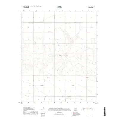
2020 Map of Smith Ranch
USGS Topo · Published 2020About this map
The high plains of Curry County are defined by the winding course of Frio Draw, which cuts through the grid of agricultural section lines in this corner of eastern New Mexico. Central to the area is the Smith Ranch, situated along the northern banks of the draw. This landscape is a classic example of the Llano Estacado's cattle and ranching culture, where the land is strictly partitioned by an extensive network of rural routes such as Curry Road 34 and Curry Road 26. The map illustrates how local topography, particularly Creek Q, dictates the placement of homesteads and water access in an otherwise uniform environment. For those researching the history of the High Plains, this survey documents the persistent ranching infrastructure and the specific road systems that have connected these remote homesteads for generations.
Find a feature on this map
25 named features on this map. Tap any name to fly to it.
Don’t see what you’re looking for? This feature index may not catch every label — zoom into the map to look around manually.
Map Details
Editions of this 2020 Smith Ranch Map
This is the sole edition of this map. No revisions or reprints were ever made.
Other maps of this area

1954 · Clovis
USGS Topo · 1:250,000

1957 · Pleasant Hill
USGS Topo · 1:62,500

1957 · Hammond Ranch
USGS Topo · 1:62,500

1958 · Clovis
USGS Topo · 1:250,000

1971 · Broadview
USGS Topo · 1:24,000

1971 · Grady
USGS Topo · 1:24,000

1971 · Grady SW
USGS Topo · 1:24,000

1985 · Pleasant Hill NW
USGS Topo · 1:24,000

1985 · Smith Ranch
USGS Topo · 1:24,000
1985 · Garrett Ranch
USGS Topo · 1:24,000