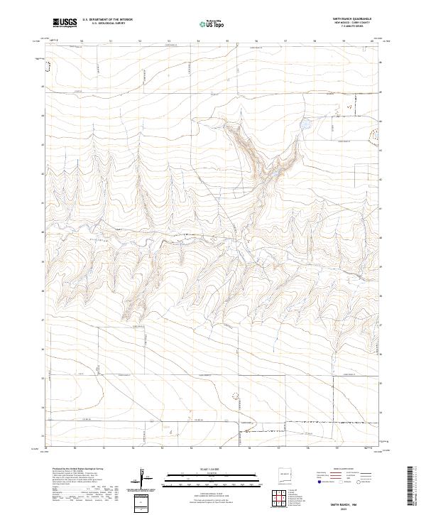
2023 Map of Smith Ranch
USGS Topo · Published 2023About this map
Frio Draw carves a path through the high plains of Eastern New Mexico, defining the drainage patterns in this corner of Curry County. The landscape is dominated by a grid-like network of rural transit lines, including Curry Road 34 along the northern edge and Co Rd 26 to the south. This systematic road structure, featuring identifiers like Curry Road 27 and Co Rd 33, underscores the region's agricultural organization and land division. Unlike more densely populated areas, this territory is characterized by its wide-open ranching terrain, where water features like Creek Q and the complex topography of the draws provide the primary landmarks for navigation and local land management.
Find a feature on this map
25 named features on this map. Tap any name to fly to it.
Don’t see what you’re looking for? This feature index may not catch every label — zoom into the map to look around manually.
Map Details
Editions of this 2023 Smith Ranch Map
This is the sole edition of this map. No revisions or reprints were ever made.
Other maps of this area

1954 · Clovis
USGS Topo · 1:250,000

1957 · Pleasant Hill
USGS Topo · 1:62,500

1957 · Hammond Ranch
USGS Topo · 1:62,500

1958 · Clovis
USGS Topo · 1:250,000

1971 · Broadview
USGS Topo · 1:24,000

1971 · Grady
USGS Topo · 1:24,000

1971 · Grady SW
USGS Topo · 1:24,000

1985 · Pleasant Hill NW
USGS Topo · 1:24,000

1985 · Smith Ranch
USGS Topo · 1:24,000
1985 · Garrett Ranch
USGS Topo · 1:24,000