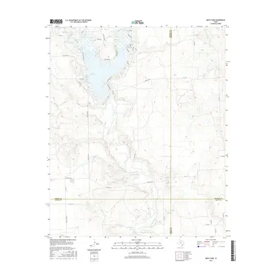
2016 Map of Smith Tank
USGS Topo · Published 2016About this map
White River Lake dominates the upper landscape of this West Texas region, where the White River carves south through the meeting points of Crosby, Dickens, and Garza counties. The terrain is marked by the distinct escarpment of the Llano Estacado Rd, reflecting the transition from the high plains down toward the river basin. Tracing the water's path reveals several tributaries, including Davidson Cr and Sand Cr, which drain into the reservoir. A network of ranch and county roads, such as Comanche Trl and Wagon Rd, crisscrosses the high ground, while the eponymous Smith Tank sits further south near the river's winding course. This mapping shows the significant role of water management in a semi-arid landscape, evidenced by the reservoir and various named tanks and creeks like Home Cr that define the local topography and land use.
Find a feature on this map
39 named features on this map. Tap any name to fly to it.
Don’t see what you’re looking for? This feature index may not catch every label — zoom into the map to look around manually.
Map Details
Editions of this 2016 Smith Tank Map
This is the sole edition of this map. No revisions or reprints were ever made.
Other maps of this area

1954 · Lubbock
USGS Topo · 1:250,000

1961 · Bunker Hill
USGS Topo · 1:24,000

1962 · Twomile Creek
USGS Topo · 1:24,000

1962 · Smith Tank
USGS Topo · 1:24,000

1966 · Kalgary
USGS Topo · 1:24,000

1966 · Collett Springs
USGS Topo · 1:24,000

1967 · Spur NW
USGS Topo · 1:24,000

1968 · Foreman Chapel
USGS Topo · 1:24,000

1968 · Spur SW
USGS Topo · 1:24,000

1969 · Verbena
USGS Topo · 1:24,000