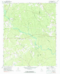
1972 Map of Smithboro
USGS Topo · Published 1991About this map
Murder Creek and its many tributaries, including Whitehouse Br and Broddus Br, define the drainage patterns across this rural section of the Georgia Piedmont during the early 1970s. The landscape is split between the wooded expanse of the Oconee National Forest and active agricultural or timber lands, marked by an extensive network of jeep trails and a major Pipeline corridor. The small settlement of Smithboro serves as a local hub, situated near the Central of Georgia railroad line and the intersection of local routes like Smithboro Road.
Find a feature on this map
23 named features on this map. Tap any name to fly to it.
Don’t see what you’re looking for? This feature index may not catch every label — zoom into the map to look around manually.
Map Details
Editions of this 1972 Smithboro Map
2 editions found
Other maps of this area

1953 · Athens
USGS Topo · 1:250,000

1958 · Athens
USGS Topo · 1:250,000

1959 · Athens
USGS Topo · 1:250,000

1963 · Athens
USGS Topo · 1:250,000

1964 · Stanfordville
USGS Topo · 1:24,000

1964 · Hillsboro
USGS Topo · 1:24,000

1972 · Monticello
USGS Topo · 1:24,000

1972 · Eatonton
USGS Topo · 1:24,000

1972 · Shady Dale
USGS Topo · 1:24,000
1972 · Smithboro
USGS Topo · 1:24,000