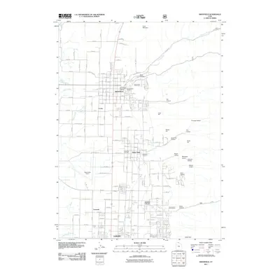
2011 Map of Smithfield
USGS Topo · Published 2011About this map
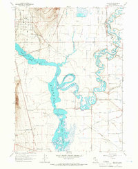
Smithfield and Hyde Park anchor this Cache Valley landscape, where residential blocks give way to a complex system of canyons and hollows to the east. The 2011 layout shows the transition from the city of Logan through North Logan and the smaller settlement of Greenville, illustrating the northward expansion of the valley's primary urban corridor. Aviation and industry are represented by the Logan-Cache Airport on the western flats, while the eastern terrain is defined by dramatic features like Birch Canyon, Hyde Park Canyon, and the prominent Crow Mountain. Local history is preserved in the grounds of the Smithfield City Cemetery and Hyde Park Cemetery, while the Hyde Park Post Office marks the center of that community. The land uses vary from the recreational Summit Park Golf Course to the specialized Green Canyon Forest Nursery, all situated against a backdrop of numerous named hollows such as Bogus Hollow and Beef Hollow.
Find a feature on this map
105 named features on this map. Tap any name to fly to it.
Don’t see what you’re looking for? This feature index may not catch every label — zoom into the map to look around manually.
Map Details
Editions of this 2011 Smithfield Map
This is the sole edition of this map. No revisions or reprints were ever made.
Other maps of this area

1914 · Logan
USGS Topo · 1:125,000

1916 · Logan
USGS Topo · 1:125,000

1954 · Ogden
USGS Topo · 1:250,000

1958 · Ogden
USGS Topo · 1:250,000

1960 · Ogden
USGS Topo · 1:250,000

1961 · Logan
USGS Topo · 1:24,000
1962 · Wellsville
USGS Topo · 1:24,000
1964 · Smithfield
USGS Topo · 1:24,000
1964 · Richmond
USGS Topo · 1:24,000
1964 · Newton
USGS Topo · 1:24,000