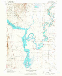
1964 Map of Newton
USGS Topo · Published 1966About this map
Newton and the surrounding agricultural landscape of Cache County are defined by a complex network of water management and irrigation just after the mid-century. The Cutler Reservoir dominates the central terrain, where the Bear River and Little Bear River converge near Horseshoe Bend. This area shows the intricate engineering of the Cache Canal, the North Logan Benson Canal, and various flumes and aqueducts that supported the local sugar beet and dairy economies. Small settlements like Amalga and Benson are visible alongside local infrastructure such as the Benson Sch. The landscape is also marked by transportation history, featuring the Union Pacific line and the Old Railroad Grade which cuts across the marshy lowlands of The Barrens Slough. Notable landmarks like Quigley Crossing and the prominent height of The Point provide fixed points for genealogists tracing family lands in this part of the Cache Valley.
Find a feature on this map
35 named features on this map. Tap any name to fly to it.
Don’t see what you’re looking for? This feature index may not catch every label — zoom into the map to look around manually.
Map Details
Editions of this 1964 Newton Map
3 editions found
Other maps of this area

1914 · Logan
USGS Topo · 1:125,000

1916 · Logan
USGS Topo · 1:125,000

1954 · Ogden
USGS Topo · 1:250,000

1954 · Brigham City
USGS Topo · 1:250,000

1958 · Ogden
USGS Topo · 1:250,000

1958 · Brigham City
USGS Topo · 1:250,000

1960 · Ogden
USGS Topo · 1:250,000

1961 · Honeyville
USGS Topo · 1:24,000

1961 · Logan
USGS Topo · 1:24,000

1962 · Brigham City
USGS Topo · 1:250,000