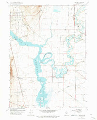
1964 Map of Newton
USGS Topo · Published 1975About this map
The confluence of the Bear River and Little Bear River dominates this landscape in the mid-1960s, creating the expansive Cutler Reservoir. The hydrology of Cache Valley is intricately mapped, showing the essential West Cache Canal, Cache Valley Canal, and numerous sloughs like The Barrens and The Slough that support the region's agricultural footprint. Settlement is concentrated in small communities such as Newton, Amalga, and Benson, the latter featuring the Benson Sch. Transport history is visible through the Union Pacific line and an Old Railroad Grade that traces an earlier route through the valley floor. Notable local landmarks like Quigley Crossing and the prominent Black Rock near The Point provide specific geographic anchors for genealogists and local historians tracing family land in this part of Utah.
Find a feature on this map
39 named features on this map. Tap any name to fly to it.
Don’t see what you’re looking for? This feature index may not catch every label — zoom into the map to look around manually.
Map Details
Editions of this 1964 Newton Map
3 editions found
Other maps of this area

1914 · Logan
USGS Topo · 1:125,000

1916 · Logan
USGS Topo · 1:125,000

1954 · Ogden
USGS Topo · 1:250,000

1954 · Brigham City
USGS Topo · 1:250,000

1958 · Ogden
USGS Topo · 1:250,000

1958 · Brigham City
USGS Topo · 1:250,000

1960 · Ogden
USGS Topo · 1:250,000

1961 · Honeyville
USGS Topo · 1:24,000

1961 · Logan
USGS Topo · 1:24,000

1962 · Brigham City
USGS Topo · 1:250,000