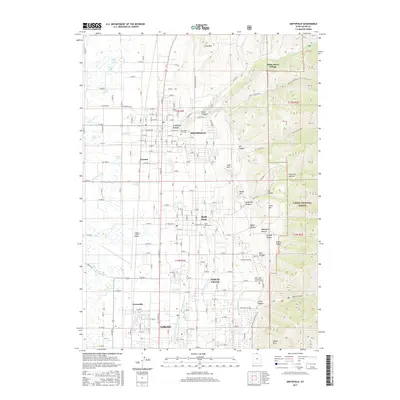
2017 Map of Smithfield
USGS Topo · Published 2017About this map
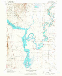
Logan and its northern neighbors occupy a complex landscape where the valley floor meets the steep western slopes of the Cache National Forest. The 2017 topography reveals an intricate water management system essential to the region, featuring the Logan Northern Canal, Benson Canal, and the Logan and Hyde Park Canal. These waterways underscore the agricultural heritage and suburban growth of Smithfield and Hyde Park. The map documents established civic landmarks like the Smithfield City Cem and the Logan-Cache Airport, which serves as a regional hub.
Find a feature on this map
102 named features on this map. Tap any name to fly to it.
Don’t see what you’re looking for? This feature index may not catch every label — zoom into the map to look around manually.
Map Details
Editions of this 2017 Smithfield Map
This is the sole edition of this map. No revisions or reprints were ever made.
Other maps of this area

1914 · Logan
USGS Topo · 1:125,000

1916 · Logan
USGS Topo · 1:125,000

1954 · Ogden
USGS Topo · 1:250,000

1958 · Ogden
USGS Topo · 1:250,000

1960 · Ogden
USGS Topo · 1:250,000

1961 · Logan
USGS Topo · 1:24,000
1962 · Wellsville
USGS Topo · 1:24,000
1964 · Smithfield
USGS Topo · 1:24,000
1964 · Richmond
USGS Topo · 1:24,000
1964 · Newton
USGS Topo · 1:24,000