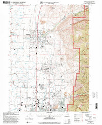
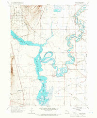
1998 Map of Smithfield
USGS Topo · Published 2001About this map
Smithfield sits at the transition between the agricultural valley floor and the rising slopes of the Cache National Forest. In the late 1990s, the area reflects a growing suburban footprint extending from North Logan toward Hyde Park, while still maintaining its agricultural roots through numerous named springs like Joseph Smith Spring and William Smith Spring. The eastern edge of the map is defined by the steep, canyon-cut terrain of the Mount Naomi Wilderness, where features such as Birch Canyon and Dry Canyon drop sharply toward the valley.
Find a feature on this map
56 named features on this map. Tap any name to fly to it.
Don’t see what you’re looking for? This feature index may not catch every label — zoom into the map to look around manually.
Map Details
Editions of this 1998 Smithfield Map
This is the sole edition of this map. No revisions or reprints were ever made.
Other maps of this area

1914 · Logan
USGS Topo · 1:125,000

1916 · Logan
USGS Topo · 1:125,000

1954 · Ogden
USGS Topo · 1:250,000

1958 · Ogden
USGS Topo · 1:250,000

1960 · Ogden
USGS Topo · 1:250,000

1961 · Logan
USGS Topo · 1:24,000
1962 · Wellsville
USGS Topo · 1:24,000
1964 · Smithfield
USGS Topo · 1:24,000
1964 · Richmond
USGS Topo · 1:24,000
1964 · Newton
USGS Topo · 1:24,000