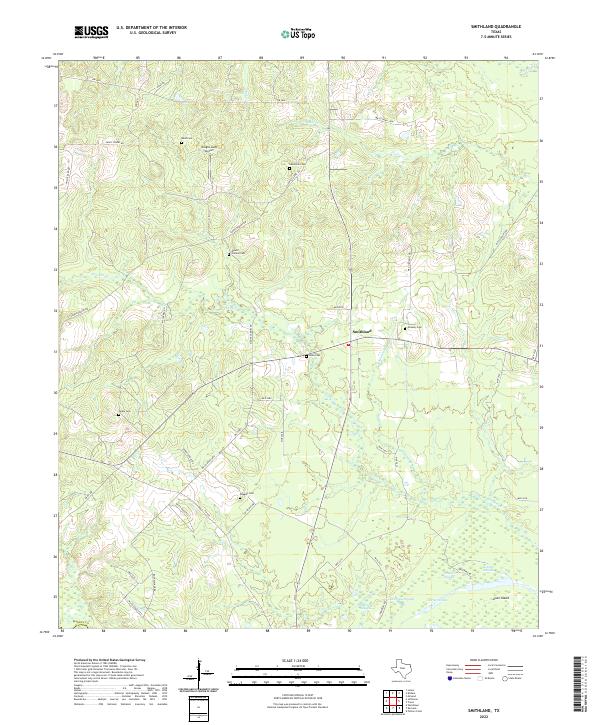
2022 Map of Smithland
USGS Topo · Published 2022About this map
Smithland serves as the focal point for this rural corner of Marion Co, where the landscape is defined by a dense network of watercourses and family burial grounds. The southern portion of the area transitions into a complex wetland system near Goat Island, featuring an intricate series of waterways including Jenkins Slough, Patterson Slough, and Carters Chute. These slow-moving waters and sloughs suggest the shifting boundaries of the local river systems over time.
Find a feature on this map
53 named features on this map. Tap any name to fly to it.
Don’t see what you’re looking for? This feature index may not catch every label — zoom into the map to look around manually.
Map Details
Editions of this 2022 Smithland Map
This is the sole edition of this map. No revisions or reprints were ever made.
Other maps of this area

1944 · Kildare
USGS Topo · 1:62,500

1944 · Caddo Lake
USGS Topo · 1:62,500

1946 · Caddo Lake
USGS Topo · 1:62,500

1948 · Kildare
USGS Topo · 1:62,500

1956 · Tyler
USGS Topo · 1:250,000
1962 · McLeod
USGS Topo · 1:24,000

1962 · Lanier
USGS Topo · 1:24,000
1962 · Trees
USGS Topo · 1:24,000

1962 · Woodlawn
USGS Topo · 1:24,000
1962 · Smithland
USGS Topo · 1:24,000