Loading...
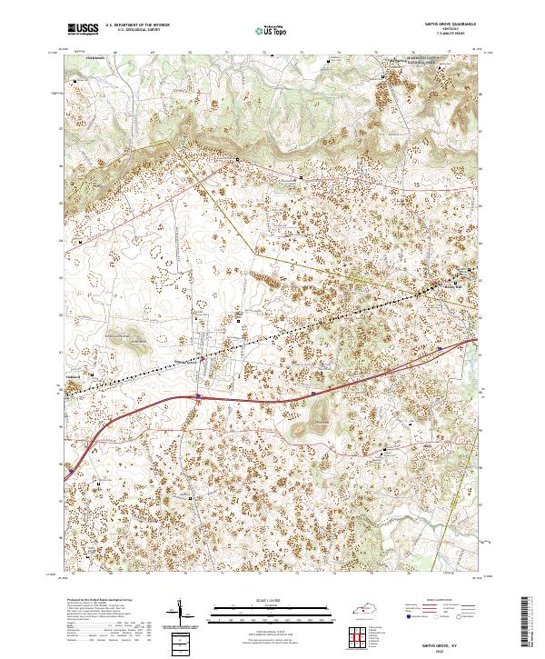
Loading map...1966 Map of Smiths Grove
USGS Topo · Published 1977About this map
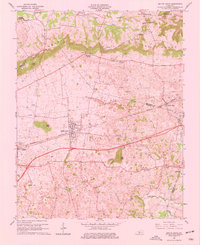
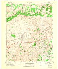
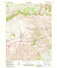
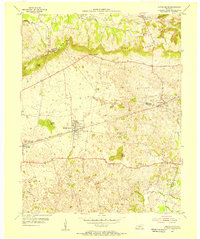
The Knobs dominate the northern landscape of this survey, marking the transition from the rolling karst plains to the more dissected terrain at the edge of Mammoth Cave National Park. The Louisville and Nashville corridor serves as the primary axis for development, anchoring the towns of Smiths Grove and Oakland. The subterranean geography of the region is hinted at through the nomenclature of features like Icy Sink Ch and the numerous depressions scattered across the farmland.
Find a feature on this map
41 named features on this map. Tap any name to fly to it.
Don’t see what you’re looking for? This feature index may not catch every label — zoom into the map to look around manually.
Map Details
Date Portrayed1966
Date Published1977
PublisherU.S. Geological Survey
Map TypeTopographic
Scale1:24,000
Physical Dimensions22 x 27 inches
Editions of this 1966 Smiths Grove Map
3 editions found
Historical Maps of Smiths Grove Through Time
7 maps found


Featured Locations
Source Details
SourceU.S. Geological Survey
CopyrightPublic Domain