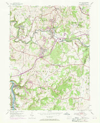
1954 Map of Smithton
USGS Topo · Published 1970About this map
Yukon and Wyano serve as central hubs in this coal-producing landscape of Westmoreland County during the mid-20th century. The terrain is deeply marked by industrial activity, including extensive Strip Mines and the Eureka Mine near the Youghiogheny River. Transportation networks are dominated by the Penn Central and Baltimore and Ohio railroads, which weave through the valleys alongside Sewickley Creek.
Find a feature on this map
76 named features on this map. Tap any name to fly to it.
Don’t see what you’re looking for? This feature index may not catch every label — zoom into the map to look around manually.
Map Details
Editions of this 1954 Smithton Map
4 editions found
Other maps of this area

1902 · Brownsville
USGS Topo · 1:62,500

1902 · Connellsville
USGS Topo · 1:62,500

1904 · Mc Keesport
USGS Topo · 1:62,500

1904 · Greensburg
USGS Topo · 1:62,500

1906 · Brownsville
USGS Topo · 1:62,500

1906 · Greensburg
USGS Topo · 1:62,500

1907 · Pittsburg
USGS Topo · 1:62,500

1931 · Brownsville
USGS Topo · 1:62,500

1931 · Connellsville
USGS Topo · 1:62,500

1933 · Brownsville
USGS Topo · 1:62,500