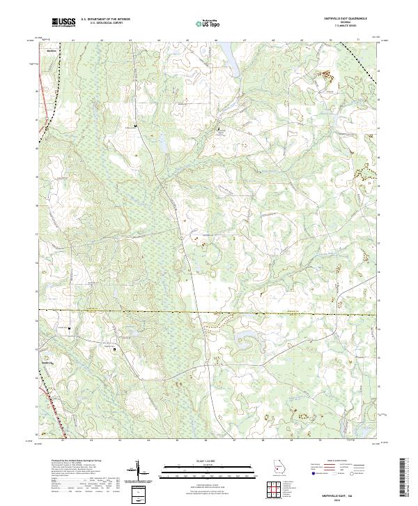
2024 Map of Smithville East
USGS Topo · Published 2024About this map
Smithville and the crossroads of Maddox anchor this rural landscape along the boundary between Sumter and Lee Counties. The terrain is defined by the winding paths of Muckalee Creek and Philema Creek, which create a complex network of wetlands and drainage through the coastal plain. For family historians, the presence of several established burial sites, including Anthony Cem, Cowart Cem, and Deidrich Cem, offers vital links to the area's ancestral residents. The New Corinth Baptist Church Cem serves as a significant community landmark near the center of the quadrangle. Local agricultural patterns are evident in the dense network of rural routes such as Bowen Rd and Wilson Battle Rd, while recreational or private waters like Ballinger Lake and Virgil Holmen Lake are scattered across the northern and central sections.
Find a feature on this map
53 named features on this map. Tap any name to fly to it.
Don’t see what you’re looking for? This feature index may not catch every label — zoom into the map to look around manually.
Map Details
Editions of this 2024 Smithville East Map
This is the sole edition of this map. No revisions or reprints were ever made.
Other maps of this area

1953 · Dothan
USGS Topo · 1:250,000

1954 · Dothan
USGS Topo · 1:250,000

1955 · Dothan
USGS Topo · 1:250,000

1955 · Phenix City
USGS Topo · 1:250,000

1956 · Leslie
USGS Topo · 1:62,500

1957 · Phenix City
USGS Topo · 1:250,000

1958 · Phenix City
USGS Topo · 1:250,000
1972 · Methvins
USGS Topo · 1:24,000
1973 · Americus
USGS Topo · 1:24,000
1973 · Lake Collins
USGS Topo · 1:24,000