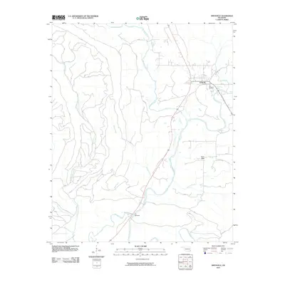
2010 Map of Smithville
USGS Topo · Published 2010About this map
Smithville sits near the eastern edge of this landscape, positioned along the winding Mountain Fork river. The community is anchored by two burial sites, the Smithville Cemetery and the Old Smithville Cemetery, providing significant points of interest for those researching local family lineages. To the south, the settlement of Nanichito is located near Roosevelt Creek, highlighting the importance of the regional creek system for rural development in McCurtain County.
Find a feature on this map
19 named features on this map. Tap any name to fly to it.
Don’t see what you’re looking for? This feature index may not catch every label — zoom into the map to look around manually.
Map Details
Editions of this 2010 Smithville Map
This is the sole edition of this map. No revisions or reprints were ever made.
Other maps of this area

1900 · Winding Stair
USGS Topo · 1:125,000

1902 · Lukfata
USGS Topo · 1:125,000

1909 · Winding Stair
USGS Topo · 1:125,000

1950 · Mcalester
USGS Topo · 1:250,000

1959 · Page
USGS Topo · 1:62,500

1960 · Bethel
USGS Topo · 1:62,500

1960 · Smithville
USGS Topo · 1:62,500

1962 · McAlester
USGS Topo · 1:250,000

1965 · McAlester
USGS Topo · 1:250,000
1966 · Ludlow
USGS Topo · 1:24,000