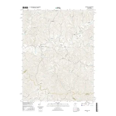
2016 Map of Smithville
USGS Topo · Published 2016About this map
Smithville sits at the confluence of several vital watercourses, including the South Fork Hughes River and Cedar Run, where the topography of West Virginia's interior creates a dense network of ridges and hollows. This 2016 survey documents a landscape defined by its small upland settlements and a remarkably high concentration of family and community burial grounds. From the northern heights at King Knob Cem down to the southern borders near Camden Flats, the map records numerous genealogy-rich sites such as Haught Cem, Reeves Cem, and Buzzard Cem. The winding paths of Leatherbark Cr and Grass Run dictate the placement of early road corridors like Leatherbark Rd. Smaller communities like Goffs, Fonzo, and Eva are linked by these narrow valley routes, which often follow the natural contours of the land rather than crossing the higher elevations like Bean Ridge or Campbell Hill.
Find a feature on this map
97 named features on this map. Tap any name to fly to it.
Don’t see what you’re looking for? This feature index may not catch every label — zoom into the map to look around manually.
Map Details
Editions of this 2016 Smithville Map
This is the sole edition of this map. No revisions or reprints were ever made.
Other maps of this area

1893 · Sutton
USGS Topo · 1:125,000

1906 · Holbrook
USGS Topo · 1:62,500

1906 · Glenville
USGS Topo · 1:62,500

1907 · Harrisville
USGS Topo · 1:62,500

1907 · Arnoldsburg
USGS Topo · 1:62,500

1924 · Harrisville
USGS Topo · 1:62,500

1924 · Holbrook
USGS Topo · 1:62,500

1925 · Glenville
USGS Topo · 1:62,500

1925 · Arnoldsburg
USGS Topo · 1:62,500

1926 · Harrisville
USGS Topo · 1:62,500