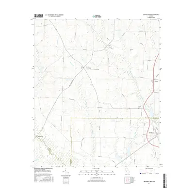
2017 Map of Smithville West
USGS Topo · Published 2017About this map
Smithville stands at the southeastern edge of this terrain where the boundaries of Lee, Sumter, and Terrell Counties converge. The landscape is defined by a dense network of watercourses, including Muckaloochee Cr and Chokeelagee Cr, which feed into local impoundments like Thomas Millpond and Wells Millpond. These water features, alongside numerous branches and creeks, shaped the placement of early settlements and rural infrastructure.
Find a feature on this map
72 named features on this map. Tap any name to fly to it.
Don’t see what you’re looking for? This feature index may not catch every label — zoom into the map to look around manually.
Map Details
Editions of this 2017 Smithville West Map
This is the sole edition of this map. No revisions or reprints were ever made.
Other maps of this area

1953 · Dothan
USGS Topo · 1:250,000

1954 · Dothan
USGS Topo · 1:250,000

1955 · Dothan
USGS Topo · 1:250,000

1955 · Phenix City
USGS Topo · 1:250,000

1956 · Leslie
USGS Topo · 1:62,500

1957 · Phenix City
USGS Topo · 1:250,000

1958 · Phenix City
USGS Topo · 1:250,000

1973 · Dawson
USGS Topo · 1:24,000
1973 · Americus
USGS Topo · 1:24,000
1973 · Plains
USGS Topo · 1:24,000