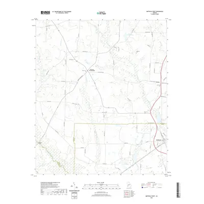
2020 Map of Smithville West
USGS Topo · Published 2020About this map
Kinchafoonee Creek and its network of tributaries, including Chokeelaglee Cr and Muckaloochee Cr, dominate the drainage of this Southwest Georgia landscape near the Lee and Sumter county line. The settlement pattern reflects a deeply rooted agricultural history, centered around the junction at Croxton Crossroads and the rail-oriented town of Smithville. This area is punctuated by numerous family and community burial grounds, such as Rylander Cem and Blackshire Cem, which serve as vital markers for genealogical research in the region.
Find a feature on this map
72 named features on this map. Tap any name to fly to it.
Don’t see what you’re looking for? This feature index may not catch every label — zoom into the map to look around manually.
Map Details
Editions of this 2020 Smithville West Map
This is the sole edition of this map. No revisions or reprints were ever made.
Other maps of this area

1953 · Dothan
USGS Topo · 1:250,000

1954 · Dothan
USGS Topo · 1:250,000

1955 · Dothan
USGS Topo · 1:250,000

1955 · Phenix City
USGS Topo · 1:250,000

1956 · Leslie
USGS Topo · 1:62,500

1957 · Phenix City
USGS Topo · 1:250,000

1958 · Phenix City
USGS Topo · 1:250,000

1973 · Dawson
USGS Topo · 1:24,000
1973 · Americus
USGS Topo · 1:24,000
1973 · Plains
USGS Topo · 1:24,000