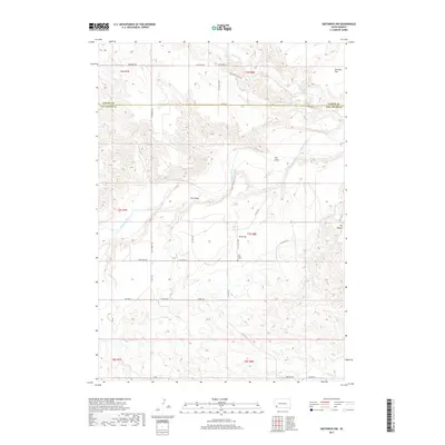
2017 Map of Smithwick NW
USGS Topo · Published 2017About this map
The Cheyenne River winds through this arid expanse of southwestern South Dakota, cutting a path through the borderlands of Custer and Fall River counties. The landscape is defined by wide sedimentary features like Harrison Flat and W G Flat, which are dissected by numerous drainages including Lame Johnny Cr, Iron Draw, and Plumb Cr. This 2017 survey reflects the remote ranching character of the region, where a network of unpaved corridors such as Ballard Ranch Rd and Ring Neck Rd connect scattered homesteads. Genealogists and local historians will find the W G Flats Cem prominently marked, serving as a primary cultural landmark in an area otherwise dominated by the natural contours of the Black Hills' southeastern fringes and geographic points like Hay Canyon.
Find a feature on this map
35 named features on this map. Tap any name to fly to it.
Don’t see what you’re looking for? This feature index may not catch every label — zoom into the map to look around manually.
Map Details
Editions of this 2017 Smithwick NW Map
This is the sole edition of this map. No revisions or reprints were ever made.
Other maps of this area

1894 · Hermosa
USGS Topo · 1:125,000

1896 · Oelrichs
USGS Topo · 1:125,000

1900 · Oelrichs
USGS Topo · 1:125,000

1901 · Hermosa
USGS Topo · 1:125,000

1950 · Buffalo Gap
USGS Topo · 1:24,000

1950 · Hot Springs SE
USGS Topo · 1:24,000

1951 · Fairburn SE
USGS Topo · 1:24,000

1951 · Smithwick NE
USGS Topo · 1:24,000

1951 · Smithwick NW
USGS Topo · 1:24,000

1955 · Hot Springs
USGS Topo · 1:250,000