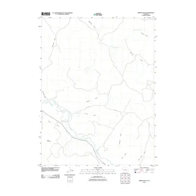
2010 Map of Smizer Gulch
USGS Topo · Published 2010About this map
Blair Mountain dominates the southwestern corner of this landscape, rising above the plateau of Blair Mesa in Rio Blanco County. The White River carves through the southern portion of the territory, accompanied by the engineered Blair Ditch, reflecting a history of water management in this arid region. The drainage network is dense with named features like Smizer Gulch and Colorow Gulch, which feed into the primary river valley. Connectivity across this dissected terrain is provided by County Rd 77 and County Rd 71. The naming of features such as Tom Little Draw and McAndrews Gulch points to the early settlers and ranching families who navigated these draws and washes, while the presence of Deep Channel Creek and Sagebrush Draw characterizes the local flora and geomorphology.
Find a feature on this map
17 named features on this map. Tap any name to fly to it.
Don’t see what you’re looking for? This feature index may not catch every label — zoom into the map to look around manually.
Map Details
Editions of this 2010 Smizer Gulch Map
This is the sole edition of this map. No revisions or reprints were ever made.
Other maps of this area

1907 · White River
USGS Topo · 1:125,000

1910 · White River
USGS Topo · 1:125,000

1954 · Vernal
USGS Topo · 1:250,000

1958 · Vernal
USGS Topo · 1:250,000

1958 · Citadel Plateau
USGS Topo · 1:62,500

1960 · Vernal
USGS Topo · 1:250,000

1960 · Elk Springs
USGS Topo · 1:62,500
1966 · Smizer Gulch
USGS Topo · 1:24,000
1966 · White River City
USGS Topo · 1:24,000
1966 · Barcus Creek SE
USGS Topo · 1:24,000