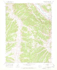
1966 Map of Barcus Creek SE
USGS Topo · Published 1969About this map
White River flows through the northeast corner of this high-plateau landscape, a region defined by deeply incised drainages and energy exploration. In the mid-1960s, the terrain was accessed primarily by a network of Jeep Trails that connected remote resource extraction sites, including a Gas Well and several Drill Holes. The hydraulic network is extensive, with Barcus Creek and Yellow Creek carving through the western sections, while Pinto Gulch and Short Gulch feed into the larger river systems. A significant Pipeline traverses the northern ridges, reflecting the industrial infrastructure established during this era of Western Colorado resource development. Near the eastern edge, Alkali Piceance Creek meanders through an area labeled simply as Flat, providing a rare break in the otherwise dissected topography.
Find a feature on this map
19 named features on this map. Tap any name to fly to it.
Don’t see what you’re looking for? This feature index may not catch every label — zoom into the map to look around manually.
Map Details
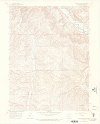
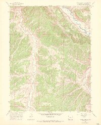
Editions of this 1966 Barcus Creek SE Map
3 editions found
Other maps of this area

1907 · White River
USGS Topo · 1:125,000

1910 · White River
USGS Topo · 1:125,000

1952 · Wolf Ridge
USGS Topo · 1:24,000

1952 · Greasewood Gulch
USGS Topo · 1:24,000

1952 · Square S Ranch
USGS Topo · 1:24,000

1954 · Vernal
USGS Topo · 1:250,000

1956 · Grand Junction
USGS Topo · 1:250,000

1958 · Vernal
USGS Topo · 1:250,000

1959 · Grand Junction
USGS Topo · 1:250,000

1960 · Vernal
USGS Topo · 1:250,000