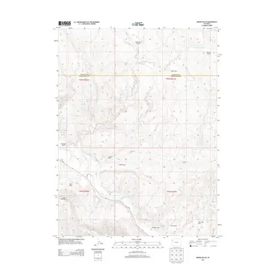
2013 Map of Smizer Gulch
USGS Topo · Published 2013About this map
The White River winds through the southern portion of this high-plateau landscape, tracing a path south of Blair Mesa and the prominent Blair Mountain. This 2013 survey of the borderlands between Rio Blanco and Moffat counties reveals a terrain defined by complex drainage systems and semi-arid gulches. The elevation drops sharply from the southern peaks into a network of canyons including Colorow Gulch, Smizer Gulch, and Kissinger Gulch. Historical water management is evident in the presence of the Blair Ditch, while the remote character of the region is emphasized by the expansive reaches of Crooked Wash and Deep Channel Creek. Roads such as Co-64 and Co Road 77 provide limited access through these dramatic elevation shifts, connecting the river valley to the north and east.
Find a feature on this map
23 named features on this map. Tap any name to fly to it.
Don’t see what you’re looking for? This feature index may not catch every label — zoom into the map to look around manually.
Map Details
Editions of this 2013 Smizer Gulch Map
This is the sole edition of this map. No revisions or reprints were ever made.
Other maps of this area

1907 · White River
USGS Topo · 1:125,000

1910 · White River
USGS Topo · 1:125,000

1954 · Vernal
USGS Topo · 1:250,000

1958 · Vernal
USGS Topo · 1:250,000

1958 · Citadel Plateau
USGS Topo · 1:62,500

1960 · Vernal
USGS Topo · 1:250,000

1960 · Elk Springs
USGS Topo · 1:62,500
1966 · Smizer Gulch
USGS Topo · 1:24,000
1966 · White River City
USGS Topo · 1:24,000
1966 · Barcus Creek SE
USGS Topo · 1:24,000