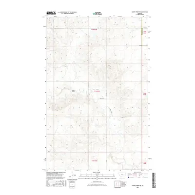
2017 Map of Smoke Creek NE
USGS Topo · Published 2017About this map
Smoke Cr defines the drainage of this northeastern Montana landscape, winding through a section of Roosevelt County near its boundary with Sheridan County. This terrain is characterized by the distinct landform of Burshia Coulee, which cuts through the central portion of the quadrangle. The map reveals a systematic grid of section lines and rural thoroughfares, such as Homestead Rd and W Homestead Rd, illustrating the persistence of early 20th-century homesteading patterns into the modern era. While the region remains sparsely settled, the detailed network of local roads like Rd 1035 and Rd 2039 highlights the continued agricultural and ranching utility of this high plains environment.
Find a feature on this map
19 named features on this map. Tap any name to fly to it.
Don’t see what you’re looking for? This feature index may not catch every label — zoom into the map to look around manually.
Map Details
Editions of this 2017 Smoke Creek NE Map
This is the sole edition of this map. No revisions or reprints were ever made.
Other maps of this area

1909 · Smoke Creek
USGS Topo · 1:62,500

1912 · Smoke Creek
USGS Topo · 1:62,500

1914 · Homestead
USGS Topo · 1:62,500

1947 · Rocky Point
USGS Topo · 1:24,000

1948 · Rocky Point
USGS Topo · 1:24,000

1950 · Coyote Coulee
USGS Topo · 1:24,000

1954 · Wolf Point
USGS Topo · 1:250,000

1958 · Wolf Point
USGS Topo · 1:250,000

1982 · Culbertson
USGS Topo · 1:100,000
1983 · Homestead NW
USGS Topo · 1:24,000