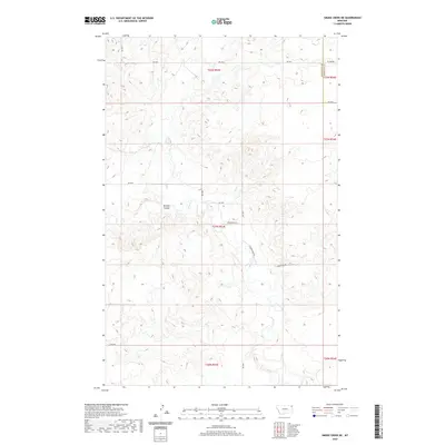
2020 Map of Smoke Creek NE
USGS Topo · Published 2020About this map
Smoke Cr and its complex network of seasonal drainage channels define this corner of the High Plains where Roosevelt and Sheridan counties meet. The landscape is characterized by intricate topographic relief, most notably the deeply carved Burshia Coulee which cuts across the western sections. The map reveals a highly structured grid of land management and transportation, where the Public Land Survey System divisions coordinate with a series of numbered rural routes. Significant thoroughfares like Homestead Rd and W Homestead Rd suggest the region's agricultural heritage, providing access to the isolated ranch and farm sites that occupy these sections. This survey provides an essential look at the modern rural infrastructure of northeastern Montana, showing how roads like Rd 2035 and Rd 1035 navigate the winding coulees and intermittent watercourses of the Missouri River watershed.
Find a feature on this map
19 named features on this map. Tap any name to fly to it.
Don’t see what you’re looking for? This feature index may not catch every label — zoom into the map to look around manually.
Map Details
Editions of this 2020 Smoke Creek NE Map
This is the sole edition of this map. No revisions or reprints were ever made.
Other maps of this area

1909 · Smoke Creek
USGS Topo · 1:62,500

1912 · Smoke Creek
USGS Topo · 1:62,500

1914 · Homestead
USGS Topo · 1:62,500

1947 · Rocky Point
USGS Topo · 1:24,000

1948 · Rocky Point
USGS Topo · 1:24,000

1950 · Coyote Coulee
USGS Topo · 1:24,000

1954 · Wolf Point
USGS Topo · 1:250,000

1958 · Wolf Point
USGS Topo · 1:250,000

1982 · Culbertson
USGS Topo · 1:100,000
1983 · Homestead NW
USGS Topo · 1:24,000